The Real Earth
Episodes 15-19EPISODE 15: THE MAPS OF THE EARTH
-----------------------------------------------------------
I know, that in episode 2 I showed you a number of globe based maps, but now it's time to take a look at some more maps. Why? Because maps are important. Maps tell us where we are, what our world looks like, and help us figure out where we're going.
The maps of history, have many differences compared to the maps of the last 100 years. Some of the maps will shock you, because they will reveal things you had no idea were even possible.
This Earth is actually far bigger than we have been told. Admiral Byrd discovered lands beyond the mapped world. The maps of history, would agree with him. Isn't it curious, how the further we go back in time, the more we knew about our world?
It's almost like humanity has some form of induced amnesia, keeping us clueless about our world. How is it possible that so much of history has been forgotten, when even to this day, we can still find traces and records of it?
To answer that question, we first have to understand the globe maps and how they lie, so we can begin to reconstruct the true map of the world.
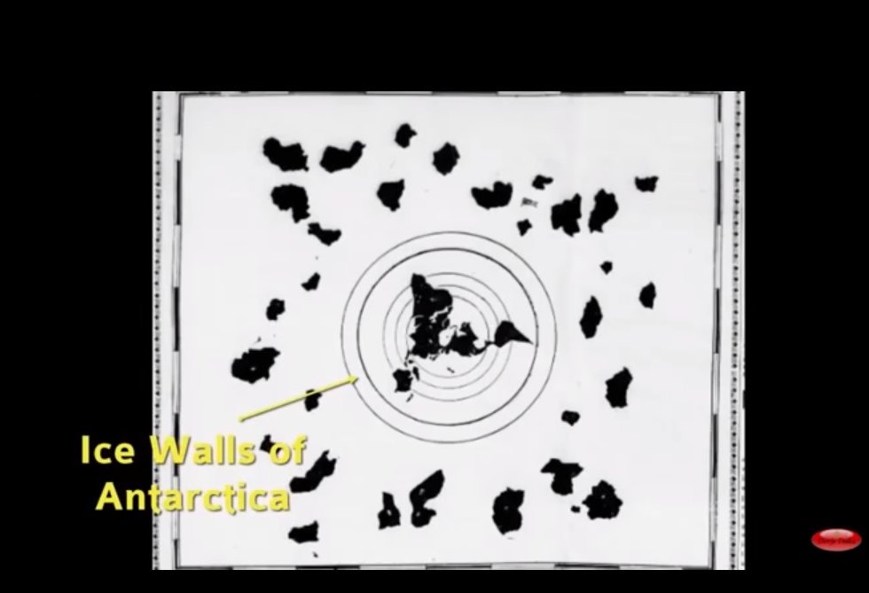
It does not take much investigation on google earth, to find significant manipulations made, over both of earth's " poles".
In the north pole you can see lines from photoshop in which they have covered up what's really there.
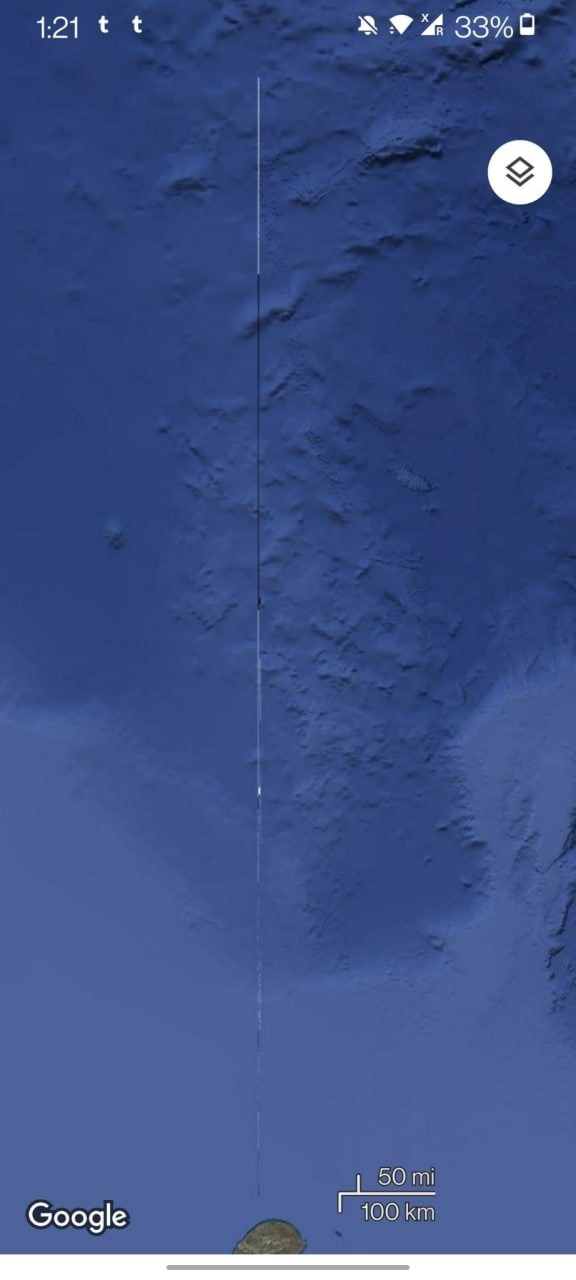
And in the south "pole" the same trickery is at play.
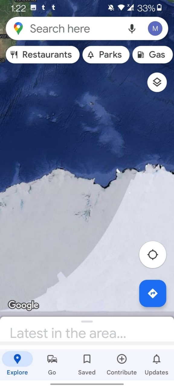
Anyone can look this up on google earth. Both "poles" are heavily manipulated, and this is important to realize, because it's how they made the globe.
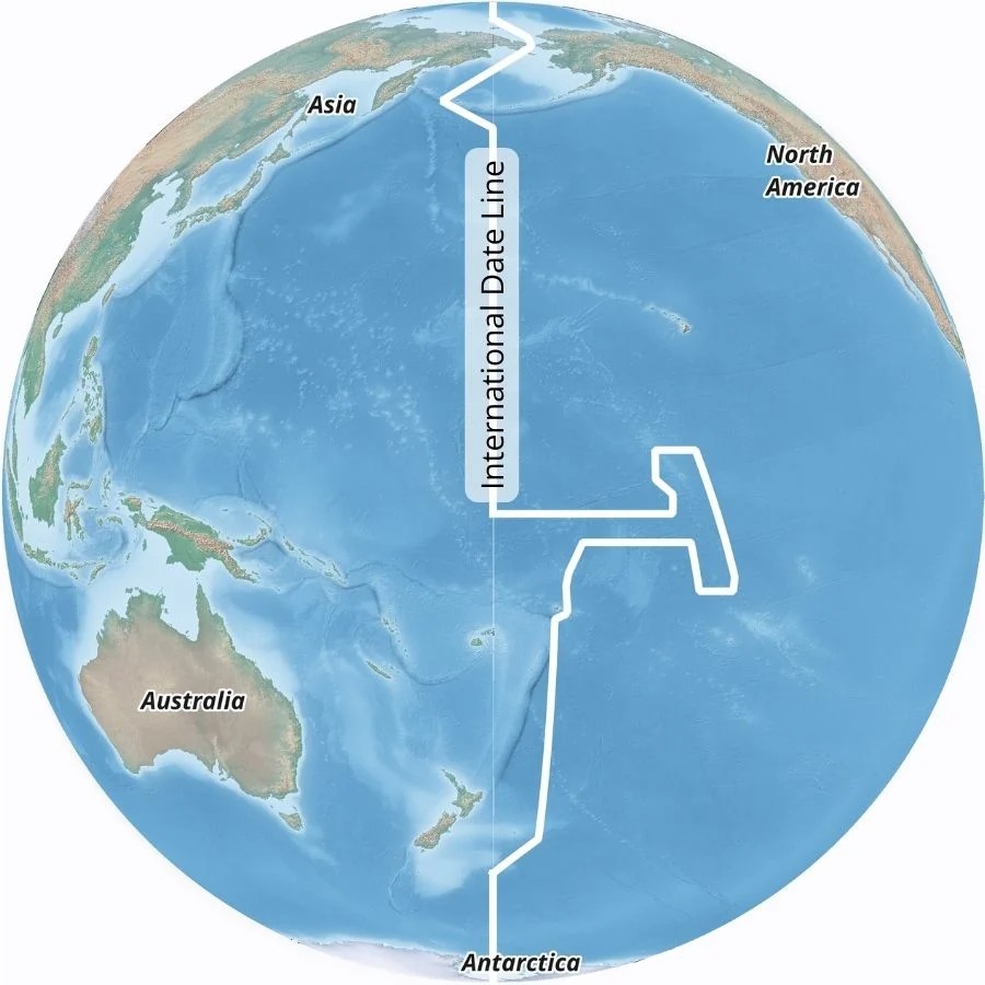
Once they created the globe, they couldn't even account for proper time zones. So they had to invent their own in order to make it work.
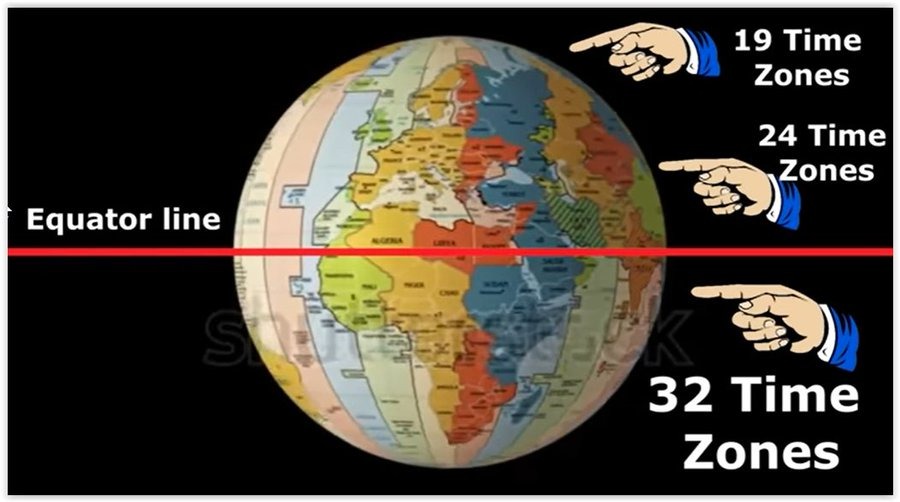
Honestly, at this point, I wish I was making this stuff up. The creation of the new timezones also lead to there being a crooked international dateline. So if anyone has ever looked at the map and wondered, why the date line is so crooked, this is why.
More will be explained about this later on. First, it's time to understand what's been hidden from us. Google Earth has clear manipulations at both the north and south "poles" because something is hidden at both poles.
On maps throughout history, they all depict land being in the north, that it is far more than just an open sea of ice, like they claim it to be. Lets take a look at some old maps.
Here's one from 1595 of the north pole.
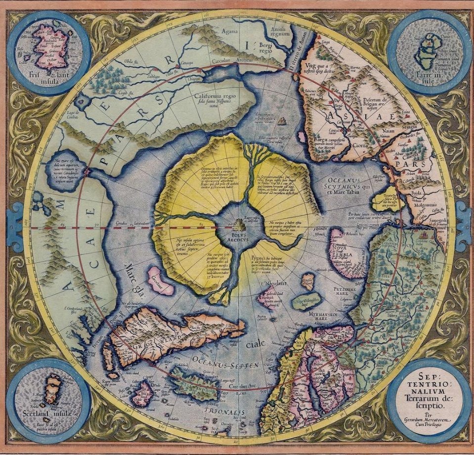
Does that look like the north pole to you? Well, throughout history, it appeared just like this on several maps, it was only in the last two hundred years that these islands in the arctic are completely missing.
Here's a video...
Rumour has it, that in the Arctic, there is a magnetic mountain, which is why all of our compasses point to it. It is said, that the Arctic, just might hide even bigger secrets, than whats beyond Antarctica.
Have you ever considered the possibility that extra terrestrial means, other lands?
In my journey through history, I came across another map, that was fascinating. A 1000 year old Japanese map which turns out to be the oldest known map ever discovered. What it depicts, tells us that we knew far more about Earth back then, than we do now.
This map reveals more than 20 continents that are outside of our known world! Although this map is seriously lacking in detail, it is by far, the oldest map we have the chance to study.
This map does however, reveal something else, regarding the wonky international date line, check out what someone figured out, in this video.
Admiral Bryd was not the only one to venture beyond Antarctica. Long before his journey, a man by the name of J.E. Barrington's. He journeyed beyond the ice wall and encountered new lands, and civilizations, and then returned to our known world to tell us about it.
Here is the account of his journey sold as a book on amazon.
https://www.amazon.com/Iron-Republic-Utopia-Beyond-Antarctica-ebook/dp/B07KX35HJS
It comes from the book The Navigator Who Cross The Ice Walls...
https://www.amazon.com/NAVIGATOR-WHO-CROSSED-ICE-WALLS/dp/9878843378
However, here's a video describing his account. There is also a 5 hour audio book that reads you the entire account, I will post both links below, and you can choose whether or not you want to spend the time learning about it.
This video is 12 minutes long.
This one is a 5 hour long audiobook.
My quest to find more maps was far from over. However, what I found next, should be considered, the greatest discovery of our time. Yet you haven't heard of it, and even many in the Flat Earth community haven't heard of it either. When I discovered this map, my mind was totally blown.
EPISODE 16: THE TRUE MAP OF THE EARTH
----------------------------------------------------------
As I stumbled through history looking at many maps, many of them so degraded over the years, that little information could be derived from them, I was beginning to lose hope that there was a real map of the Earth. I knew that even the Gleason map from 1895 was not entirely accurate.
Evidence of map manipulation goes back hundreds of years. All we have been able to do, is piece together bits and pieces from the various maps, and try to figure it out from there.
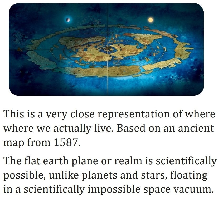
Here's one from 1587, yet again showing us the Antarctic circling the known world.
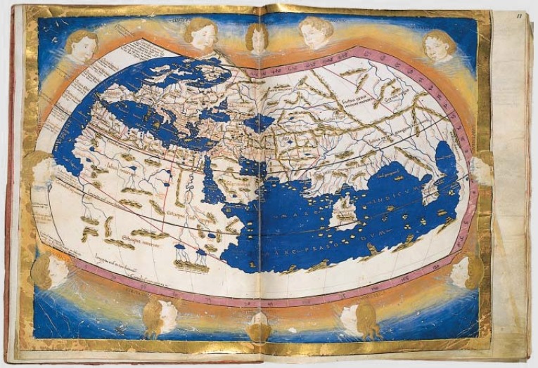
Here's Ptolemy's map from 1467...
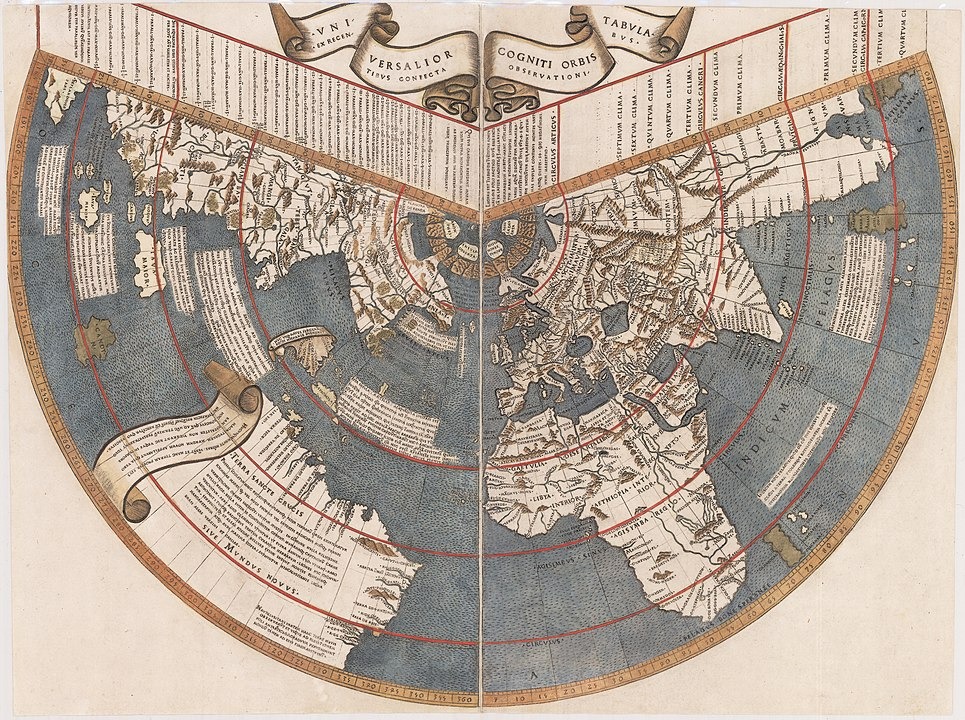
The Ruysch map from 1507...
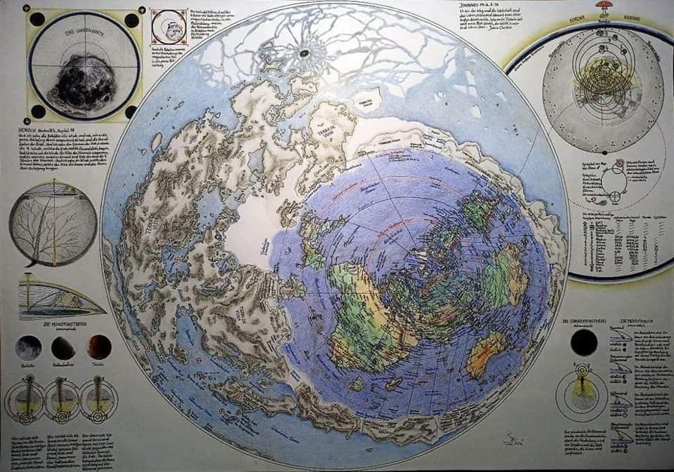
There are various other maps from history, that fluctuate wildly in what our earth looked like.
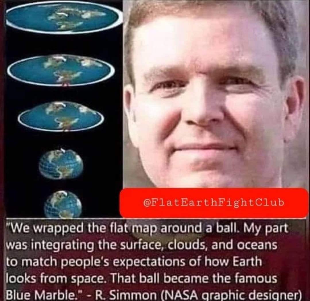
The problem with all of these maps, is they were being created from people who were trying to approximate their ideas of the earth, based on theirs, or others experiences and observations. The problem with this, is that we never really get to see the true map. But I kept digging. I had to. I knew there was a real map out there somewhere. There had to be. Since the freemasons know so much about our realm, they must know exactly what it looks like, and while the average human can try and piece it together like they have in their maps throughout the centuries, the freemasons would have a better more precise map.
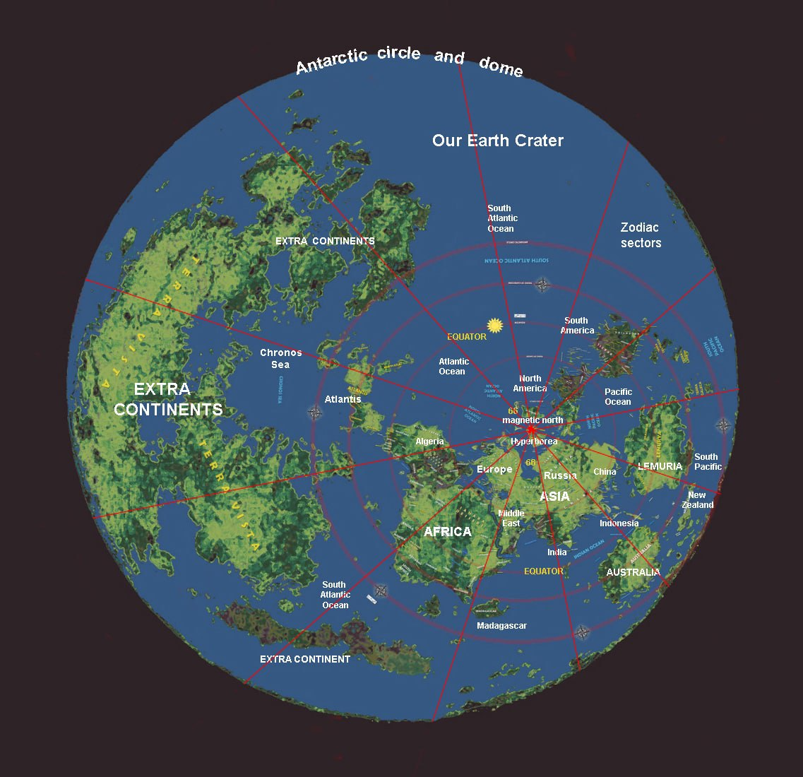
Turns out, they do. Found in the UN building, this map was hanging on the wall, as if to taunt us, as if to say, we know more than you do. As far as I know, it's the only location in which this map exists.
The known world is the color portion of the map. You can also clearly see the ice ring. Now you might ask, how do you know that this map is legit? It's a good, and valid question considering it was found in this building...
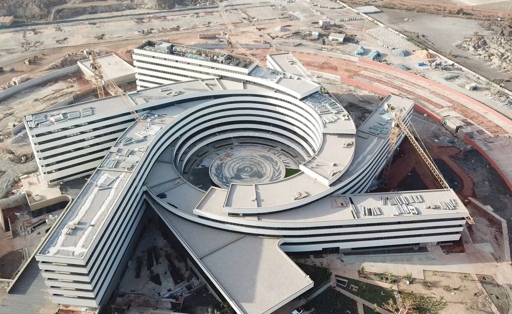
Interesting how the building also surrounds a flat earth UN logo map... It is the UN building afterall. And there's that 666 again. So trusting the map hanging up on the wall is indeed a hard pill to swallow. Yet it does seem oddly accurate based on what we know.
So I kept on digging, and what I found, was absolutely shocking. My jaw dropped to the floor, and I had to sit around for a week just in shock and awe. It's been right in front of us the whole time. The true map of the world isn't elusive, it never was, it was just in the one place that no one would ever think to look for a map, even though we see it every single day.
Have a look....
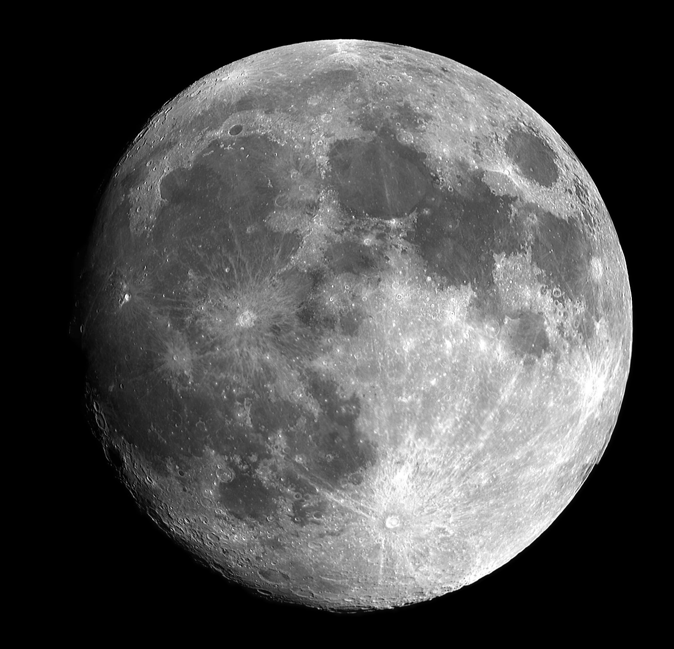
Do you see it? No, how about if we invert the image, and have a closer look?
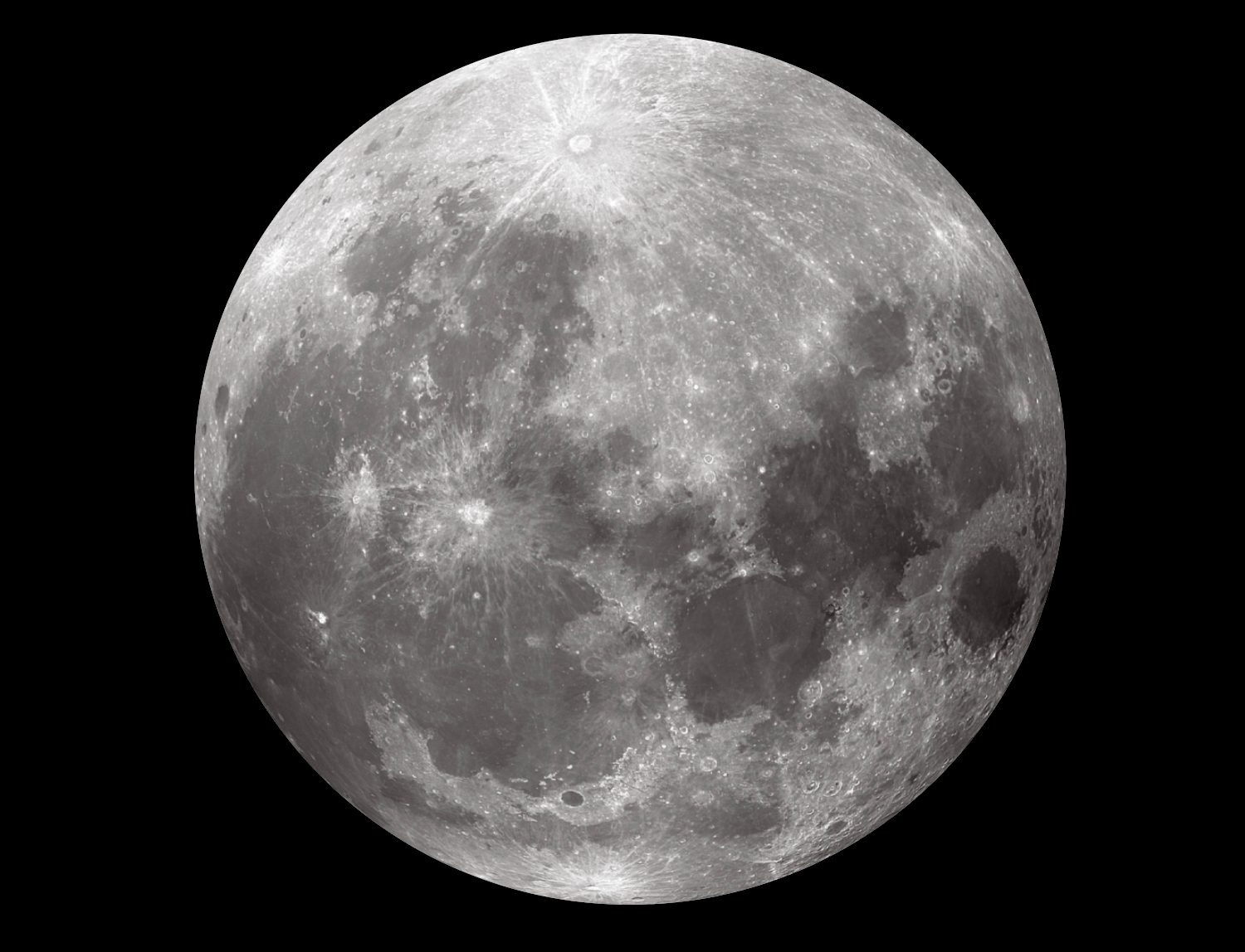
How about now? Do you see it? Allow me to show you.... Here's lets adjust the contrast a little bit.
Maybe you can see it now? Here's a video.
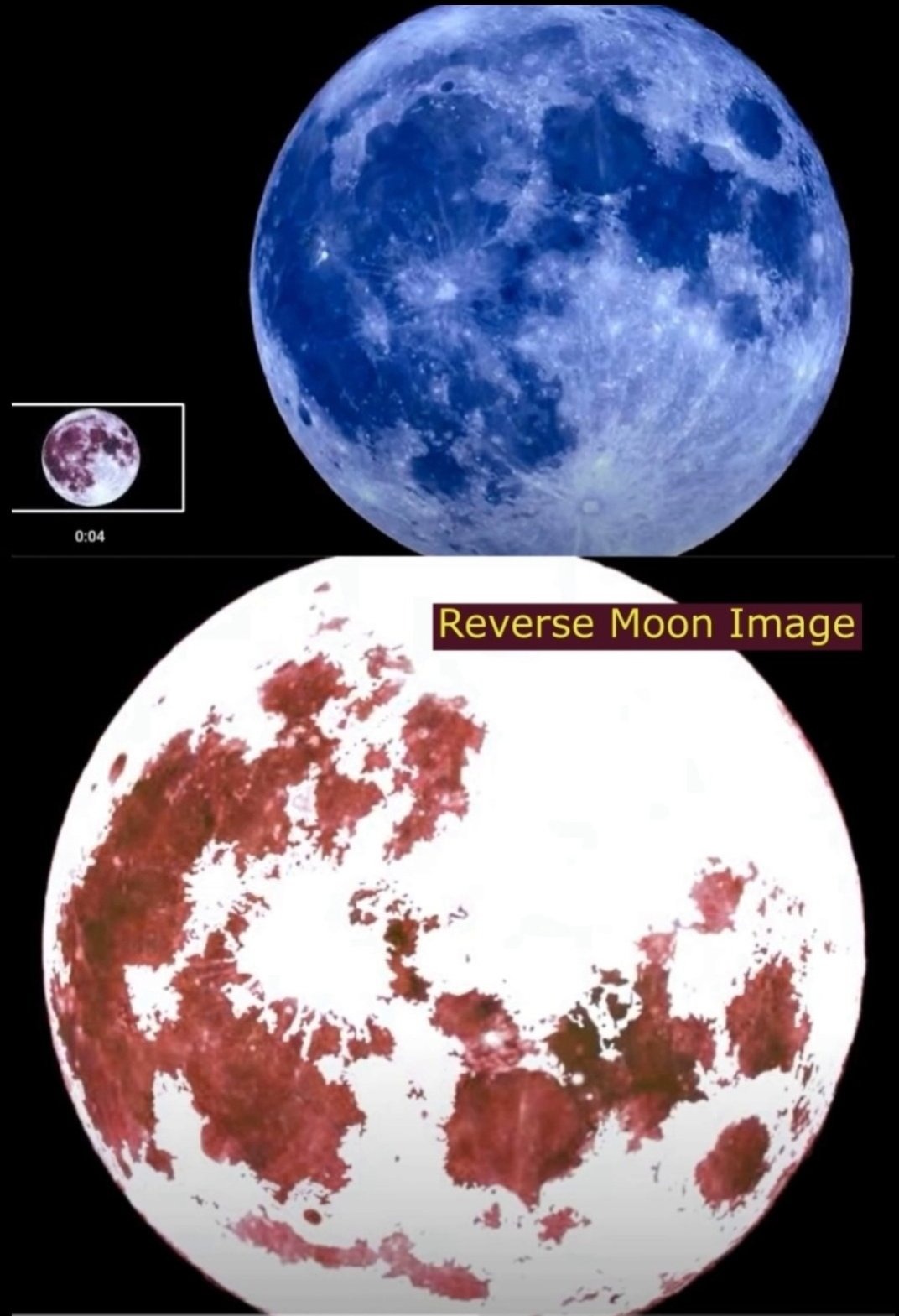
Introducing, The Moon Map.
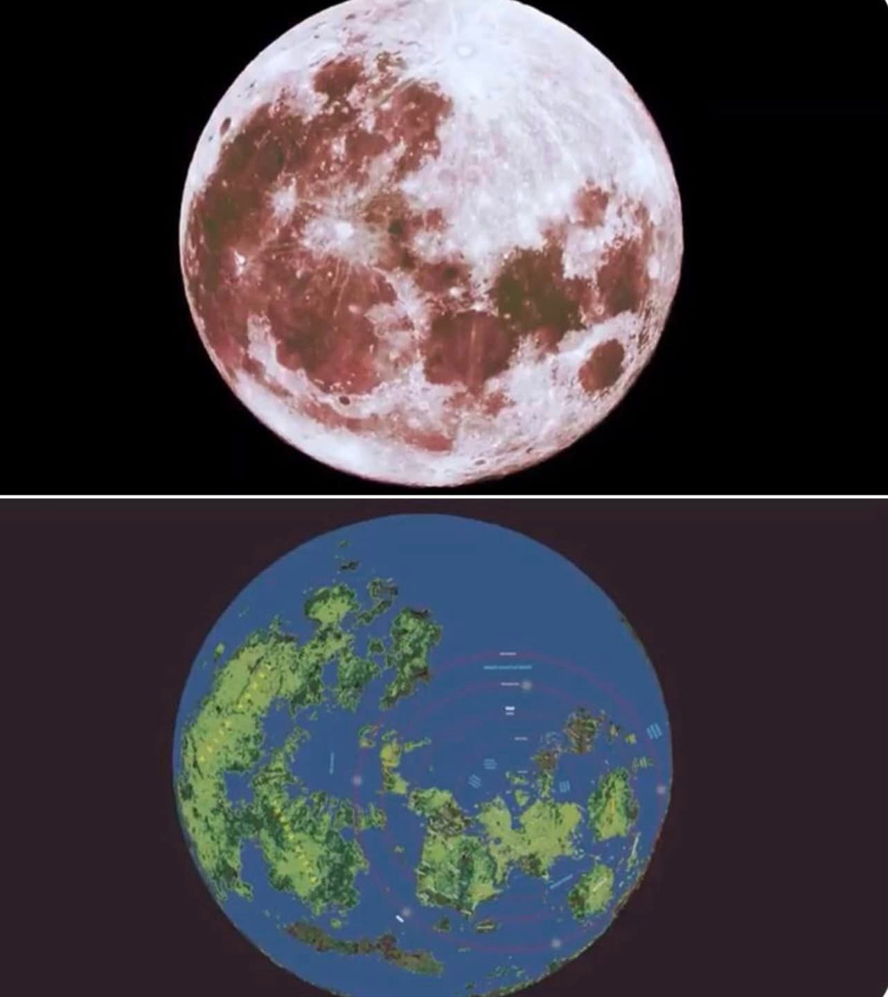
Isn't it incredible?
The known world...
And now we know that the map hanging on the wall in the UN building was in fact, a legitimate map of Earth.
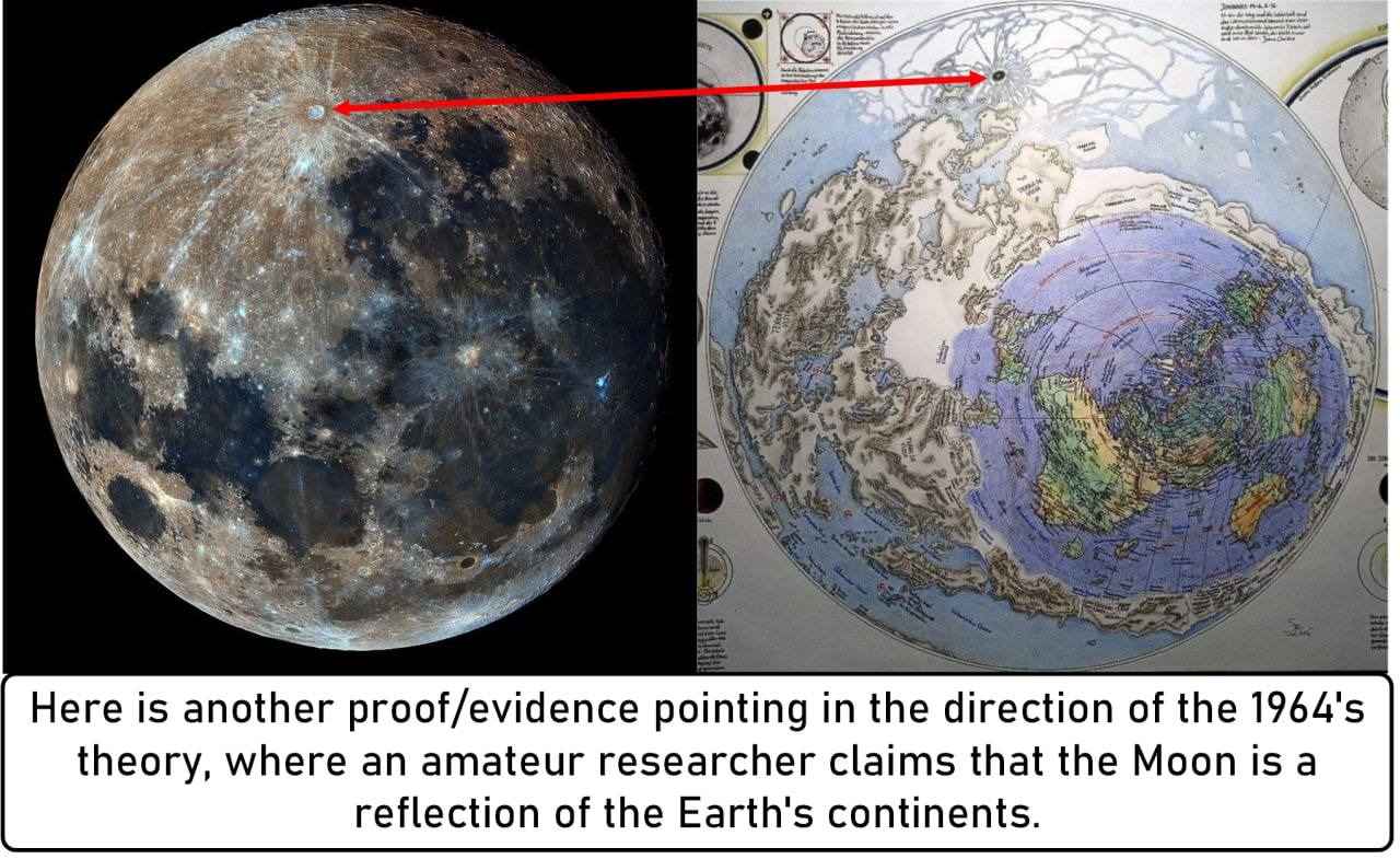
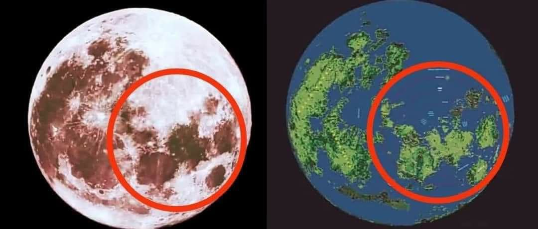
Turns out that the scientist from 1965 wasn't wrong. He knew they couldn't land on the moon, because he knew it was made of plasma. Not just any plasma, but plasma similar to an x-ray, that captured the image of Earth, at some point in history.
Take a look at how precise this map aligns with the moon. This is no coincidence.
Who new that this whole time, the moon was a map of our world, and more importantly, who figured it out, and why isn't this discovery broadcasted everywhere.... we know why. The truth, it would seem, is indeed, stranger than fiction.
There are many ways that those arguing for a 6 instead of a 9 can refute the flat earth, however, this is one of those things that really cannot be denied, or explained away. It's simply too precise, and to large to be a mere coincidence.
The Earth is a realm.
The Moon is a map.
Now wait a minute.... I know what you are thinking. You're thinking, but what about that huge landmass beside Japan, north of Australia.... That landmass doesn't exist in our world today, so this map cannot be accurate...
Or can it?
https://www.nationalgeographic.com/history/article/yonaguni-jima-japan-underwater-city
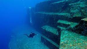
It wasn't long ago that divers dove into the waters near Japan, and discovered an entire city of ruins. So while the land may not be visible on the surface, it once was.
Clearly the moon is showing us the map of the Earth, at some point in history, it's not a reflective image, it's a captured one from who knows how long ago.
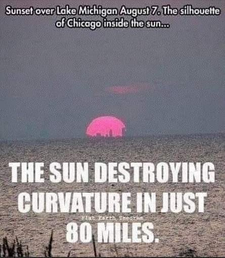
EPISODE 17: BUT WAIT! .....WHAT ABOUT THE CURVATURE? PART 1
--------------------------------------------------------------------------
I waited this long to address the curvature of the Earth, because it is often the first thing people default to the moment they are presented with the idea of a flat Earth. Because it does appear to be curvature at a glance. Therefore it's very easy to dismiss any cognitive dissonance that arises.
For that reason, I have avoided this subject until you've had a firm and solid foundation into all the other reasons why the earth is flat. Now I can show you the alternative explanations without instant dismissal.
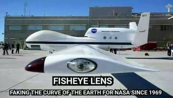
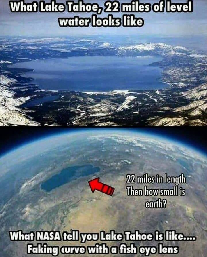
The interesting thing about curvature, is that no one has ever seen it with their eyes. It's always through a lens, like a camera lens, or a telescope, or even, an airplane window. All of these devices use what's called a fisheye lens.
NASA uses a fisheye lens for all their cameras, what a shock right?
A fish eye lens distorts the image it is looking at, and curves it. Take a look at this building edge when looking through a spyhole in a door...

Or this image, at the beach looking through a camera with a fisheye lens...
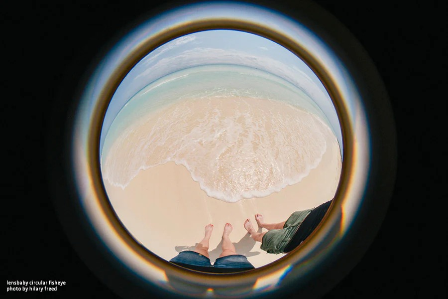
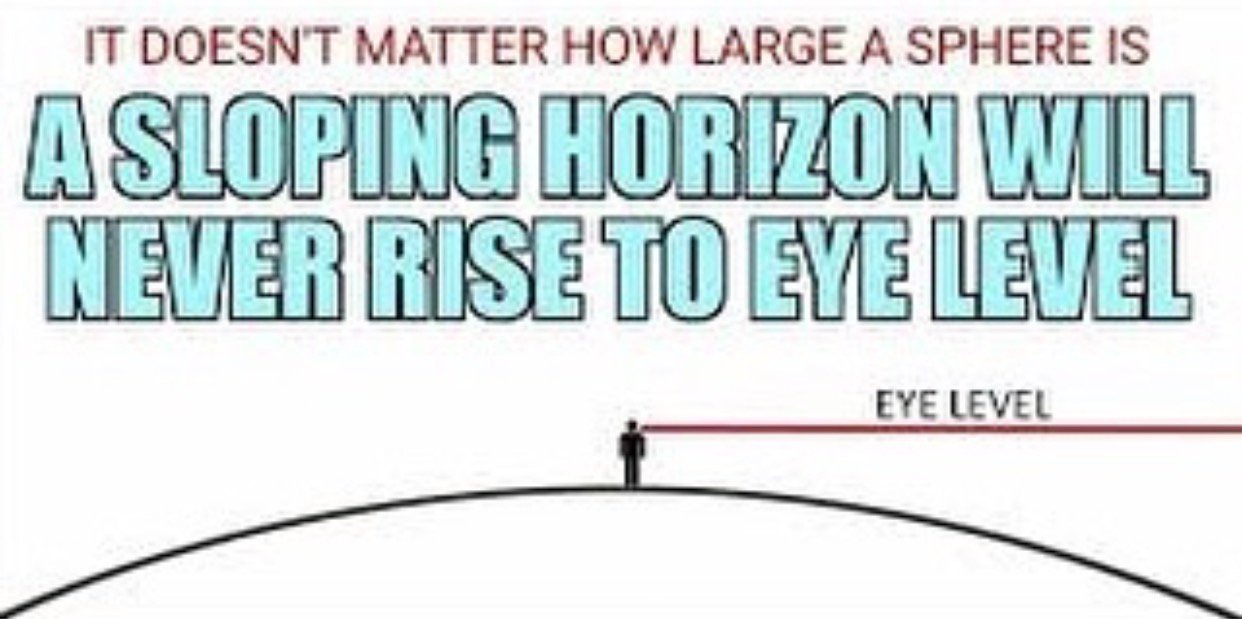
Just look at that curved horizon.... Hmm... wait a minute.... horizon.... curved? Why wouldn't it be called a curvizon? It's called a horizon, because its horizontal....
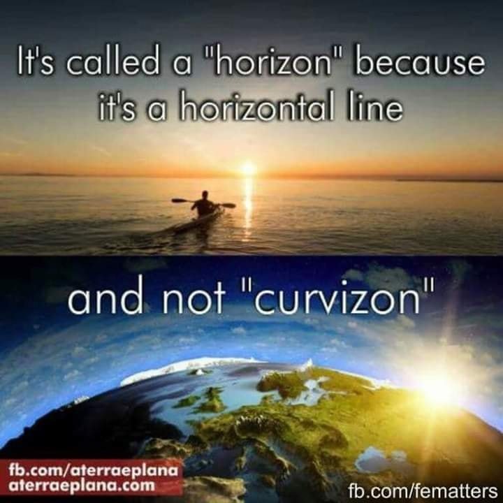
The horizon meets your eye level. It remains completely flat, from one end of your vision to the other end. You don't see a curve. No matter how high up you go.... As long as you're not using a fisheye lens, the horizon will always meet you at eye level. Every single time.
Here's another example...
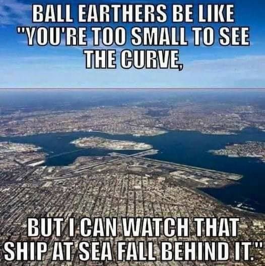
But wait! we have Bill Nye, the "$cience" guy, to $chool us in curvature...Or so he thinks...
As you can see in the second half of that video, people figured out, that when a ship disappears over the horizon, they can actually bring that ship right back into focus if they have a camera with a powerful enough zoom.
Now this wasn't enough proof for me, so of course, I went the extra mile, and decided to look back into history. Sure enough what I discovered, confirmed this to be true.
It was none other than Galileo himself. In 1609, Galileo Galilei built his own, improved telescope, which he offered to the city leaders of Venice, saying it could be used to spot ships at sea. The Venetians, pleased that they could see incoming merchant vessels two hours ahead of their competition (and therefore get a jump on the market) gave Galileo a considerable pay raise.
Ships tend to disappear about 3 miles away, that's about the limit of human vision when at sea level. After 3 miles, the boats will appear to sink into the horizon, however, Galileo's telescope enables them to see ships coming up to 10 miles away. Just by having a powerful zoom!
So what's going on here? If the Earth is flat, how do object appear to sink into the horizon... Well, interestingly enough, this phenomena happens over land, just as it does at sea. Curvature right? No.
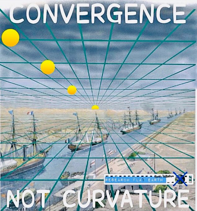
It's convergence, and vanishing point. One of the common arguments that people attempt to make to discredit flat earth, is using the curvature to hide the sun. They will say, well if the earth is flat, how is it possible that we have nights?

No matter what crosses the horizon line, it goes beyond our vision. That includes the sun. That's why it's called, the vanishing point. This video explains it quite well.
https://www.bitchute.com/video/U2cHQBBwGFpj/
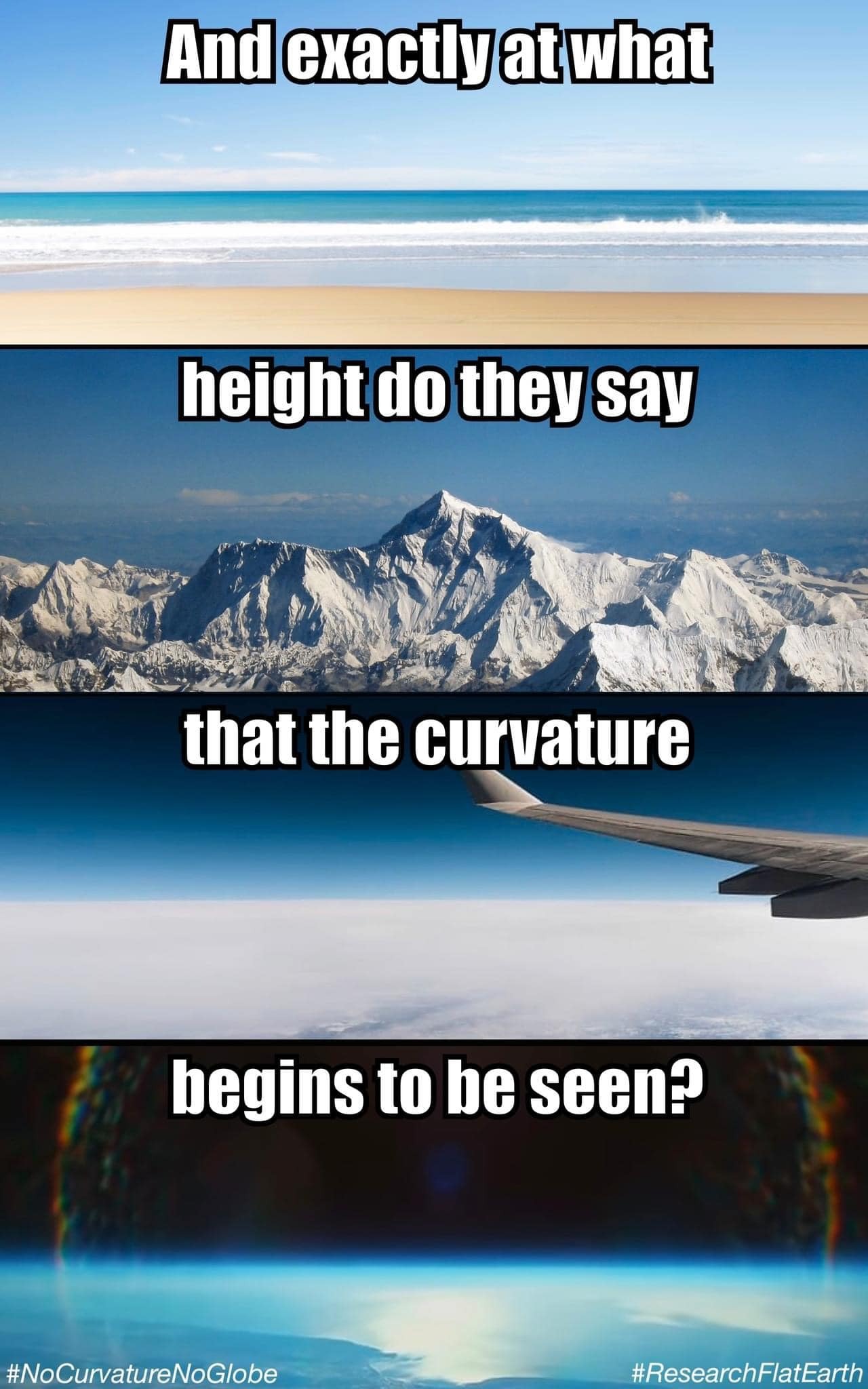
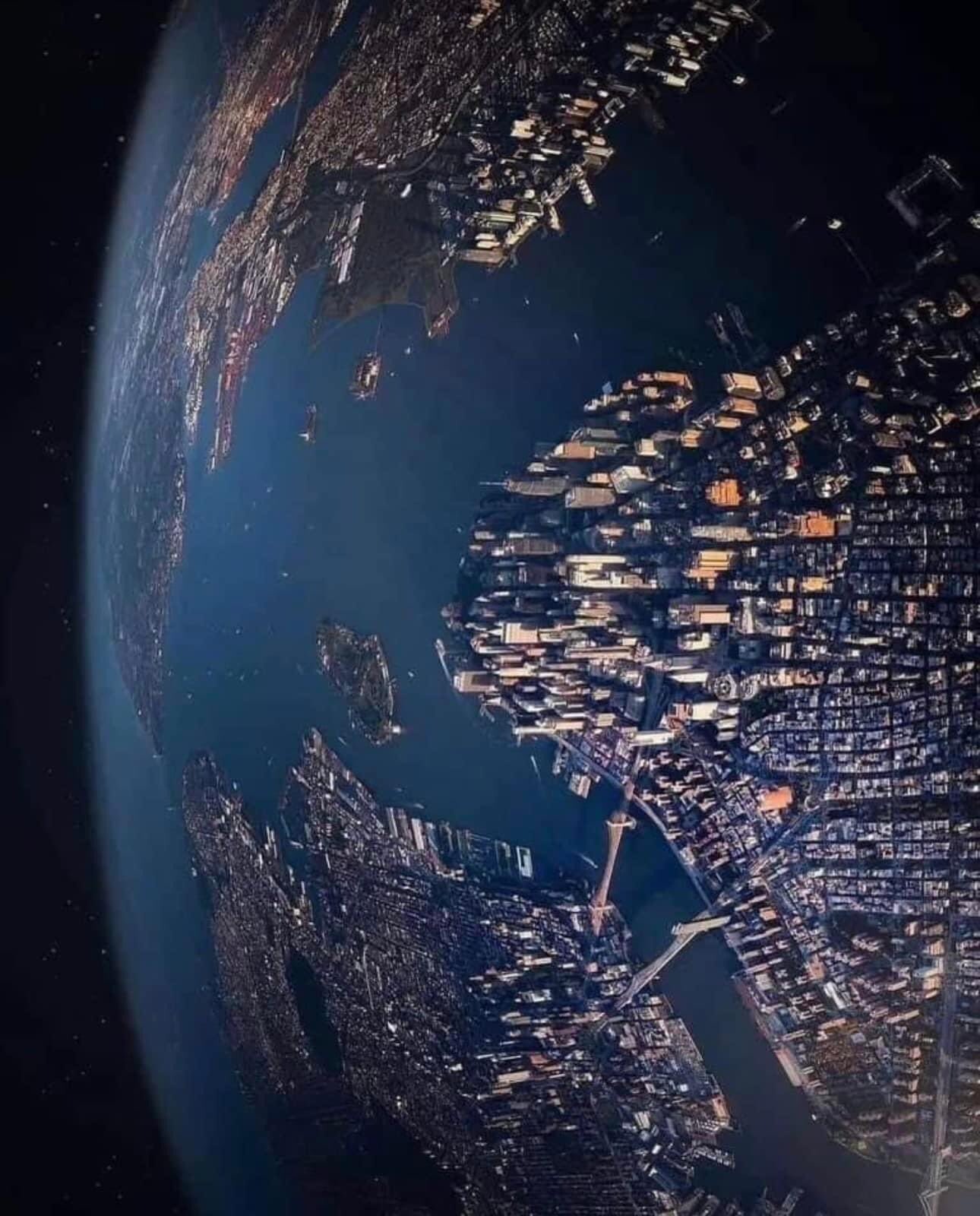
No matter how high you go, curvature cannot be observed. Even from high altitude balloons.
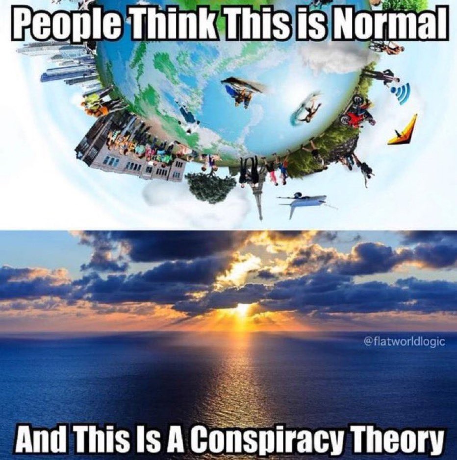
Yet, it seems, no matter how much evidence is presented, people still say...
So I'm going to show you all the reasons, on why the curvature, doesn't exist.
EPISODE 18: BUT WAIT! .....WHAT ABOUT THE CURVATURE? PART 2
--------------------------------------------------------------------------
The more you try to find curvature, the more stupid you start to feel... Curvature has never been proven, by anyone, ever. There have been many experiments throughout history that have tried to prove it, and all of them have failed, miserable.
The most often cited experiment is that of Eratosthenes, as show by Carl Sagan.
Okay, it must be true then, here's what our cities look like.
Or, we can destroy Eratosthenes theory in 21 second in this video.
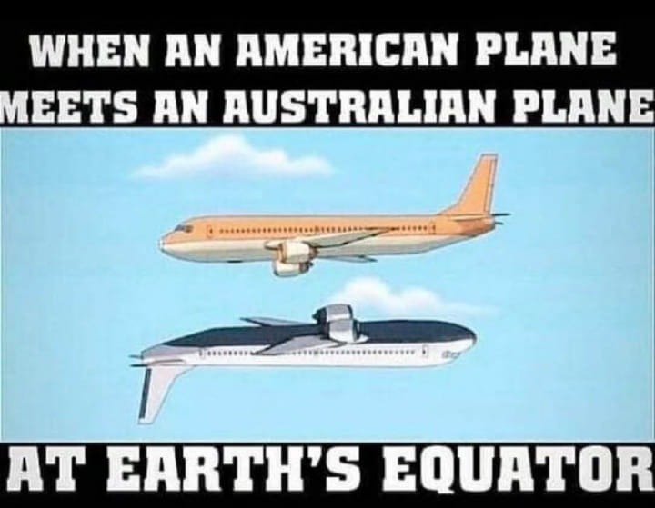
If you do want to believe in curvature, then you must also believe that plane travel looks something like this...
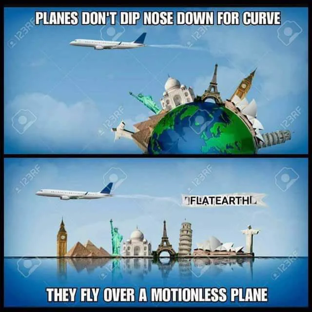
Yet, no pilot has ever been trained to account for the curvature of the earth, when learning how to fly planes. I'm sure you've noticed that when you get on a plane, after initial take off the plane levels out, and stays at that level until it's time to descend for landing.
Only then does it begin to lower in altitude. But according to curvature math, the plane would continually have to dip its nose downward, to avoid flying directly out into space.
Except if they did actually do that, this would happen....
https://www.bitchute.com/video/FkHtIq5rGeNc/
Many people have approached pilots to ask them what they think about the earth, whether it's flat or round. Here's what they had to say...
Also, if you would really like to hear more about what pilots are saying, here's a 3 hour video for you to watch...
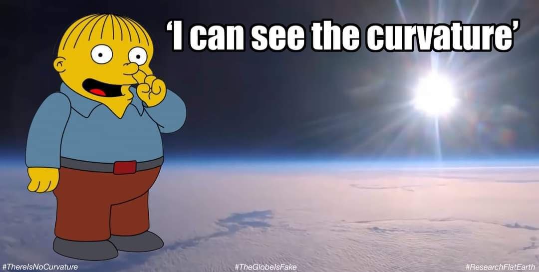
I mean, even the Simpsons, as usual, are making fun of us.
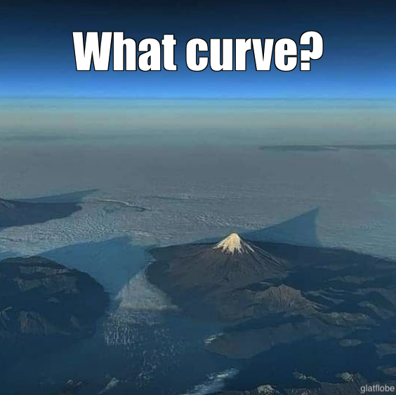
Where is the curve?
Who knew that the horizon would be a conspiracy theory?
It's really quite silly when you start to think about it. But I'm not done yet.
EPISODE 19: BUT WAIT! .....WHAT ABOUT THE CURVATURE? PART 3
--------------------------------------------------------------------------
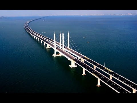
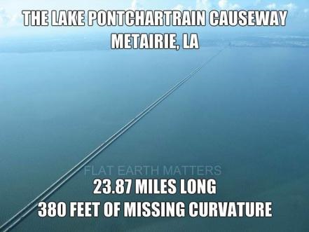
It's not just pilots that can't find any curvature. No engineer has ever accounted for it either when building roads, or canals. It never even crossed their minds that curvature might be something they would need to account for when building a 102 mile long bridge in China.
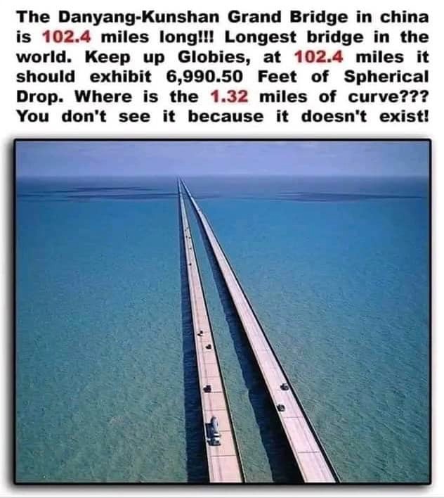
Or this one...
It also was never accounted for when they built the Suez canal.
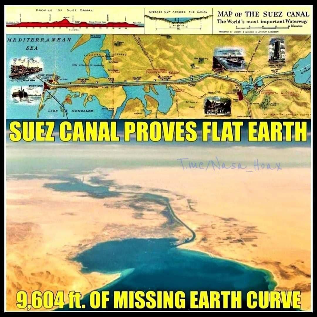
It just connects one ocean to another, completely flat all the way.
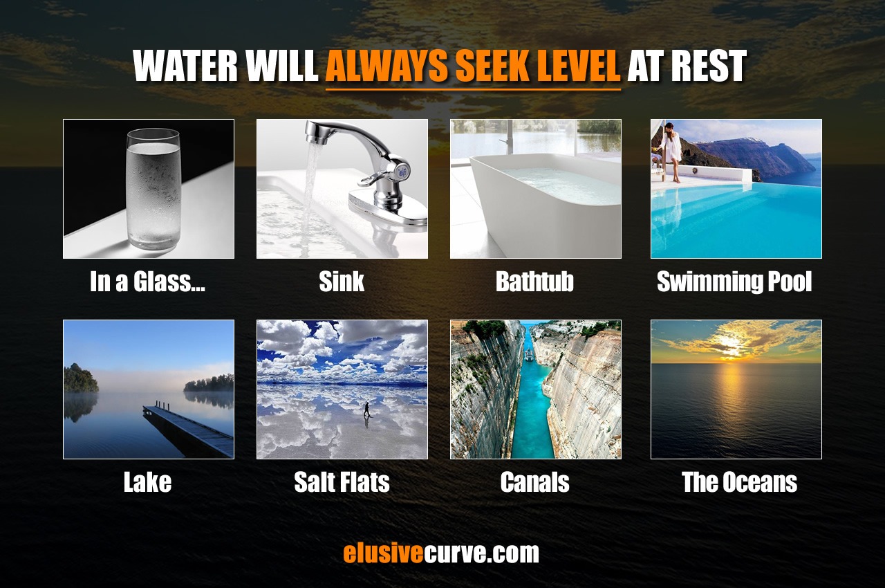
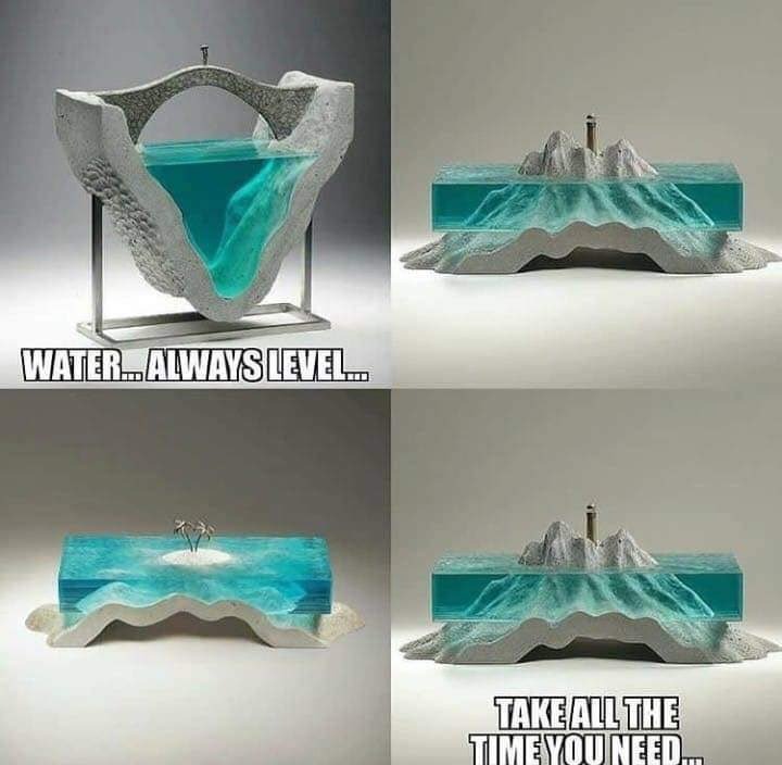
But when you stop to think about it, water itself, doesn't really like being told what to do. How often do you witness water bending? Only on its journey to find a level resting position. Such as when it goes over a water fall, or when the waves crash onto the shore in the ocean. We never see water resting in the middle of a bend. So then, doesn't that make the idea of water sticking to a ball rather stupid?
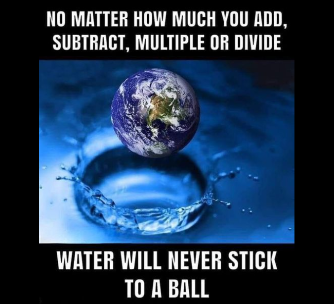
Water always seeks its level. Always. No matter what container you put it in, water wants to be resting within a container. Which is what the Antarctic ice walls provide for our oceans. We live in the Antarctic Basin.
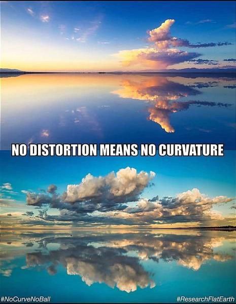
For further proof of the Earth being flat, the great salt flats in Utah, show a perfect reflection of the sky, if the Earth was curving, the reflections would be distorted. The lack of distortion proves that there is no curvature at all.
NASA again, can be exposed with their rocket launches, every single rocket launch they make, never goes straight up into space. Because they know that the rockets will hit the Firmament. So for the keen observer, when they launch a rocket, they see this, every time...
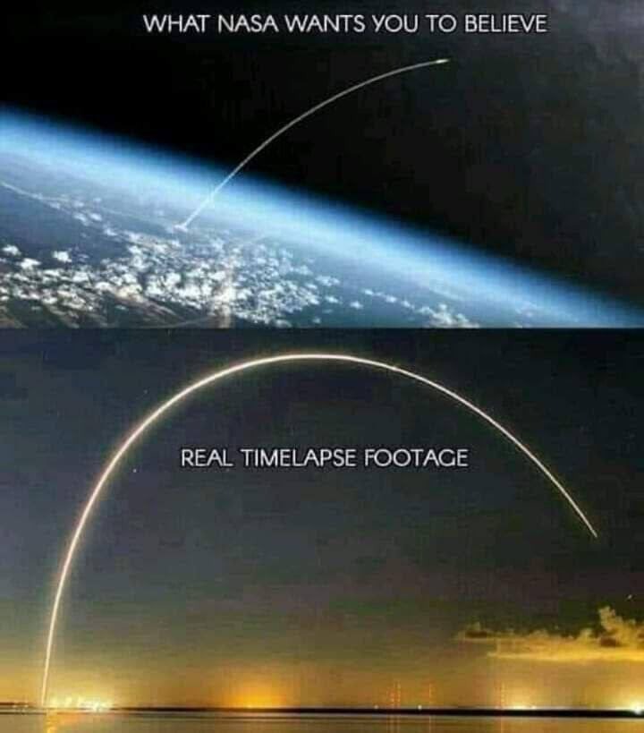
All of the rockets always curve back toward the earth, and usually come down somewhere in the Bermuda Triangle. Amazing isn't it? How they've fooled everyone so convincingly.
Another thing that disproves curvature is this cartoon right here...
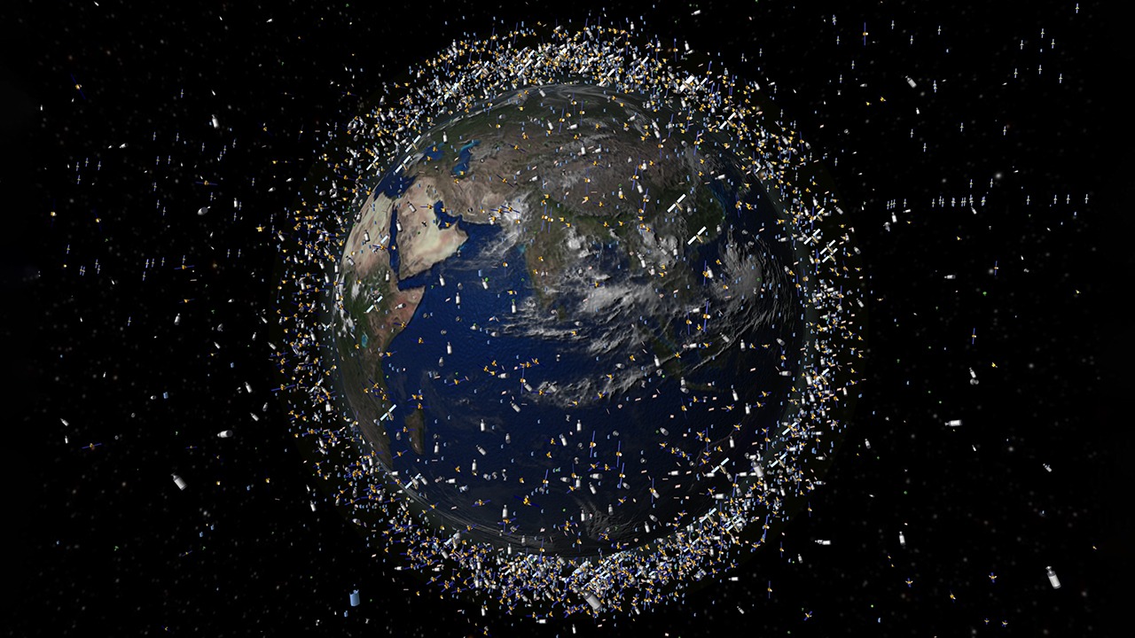
They tell us there's a lot of satellites orbiting the earth, yet we never see any of this in any footage of even NASA's fakery. This is because there are no satellites orbiting in space. This doesn't mean there aren't any satellites....
They're just of a different nature than you realize. Remember the Chinese spy balloon? That was a satellite. I recognized it instantly when it made the news, they needed to make a big deal out of it, because they didn't want to explain to the world that it was just a simple satellite. Yet there have been many other sighting of these satellites over the years.
Satellites are held up in the air by giant helium balloons. Guess who the largest consumer of helium is? NASA.... shocker right?
Even the simpsons are making fun of us, yet again.
Here's a video on a satellite hoax, and people all over the world who have come across crashed satellites.
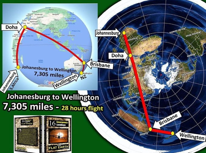
Even flight paths are non-sensical on a globe. But make perfect sense on a flat earth.
There's nothing about curvature that makes any sense at all.
Here's the link to episodes 20 - 24:
https://telegra.ph/The-Real-Earth-07-29-5
Other episode links:
Here's the link to episodes 1 - 4:
https://telegra.ph/The-Real-Earth-07-29
Here's the link to episodes 5-9:
https://telegra.ph/The-Real-Earth-07-29-2
Here's the link to episodes 10 - 14:
https://telegra.ph/The-Real-Earth-07-29-3
Here's the link to episodes 15 - 19:
https://telegra.ph/The-Real-Earth-07-29-4
Here's the link for episodes 20 - 24:
https://telegra.ph/The-Real-Earth-07-29-5
Here's the link to episodes 25 - 28:
https://telegra.ph/The-Real-Earth-07-29-6
Here's the link to episodes 29 - 30:
https://telegra.ph/The-Real-Earth-07-29-7