OSINT Exercise #001 walkthrough
I have recently developed an interest in OSINT as a side hobby and thought I'd start sharing some of the exercises I've done.
Sofia Santos has a great collection of them so I set myself a goal of solving them all. And post about it. Maybe one or two a week.. Or one every two weeks. I hope I'll manage to stay somewhat consistent anyway.
Disclaimer: all copyrighted material in this post (if any) is for educational purposes only. I do not own the copyright on any of the images in this post.
Here's the first exercise: https://gralhix.com/list-of-osint-exercises/osint-exercise-001/
Task briefing:
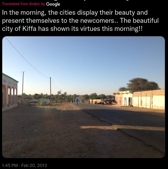
Below you can see a screenshot from a tweet containing a photo. It contains all the relevant information necessary to help you find the exact location.
Please identify the coordinates of where the photo was taken.
Exercise level:
For beginners: Hard
For experts: Medium
Let's begin.
In the tweet you could see that it's city of Kiffa. Searching web for Kiffa shows that it's Kiffa, Mauritania. Considering original tweet was made in Arabic (which we can see from the screenshot) and Arabic is official language in Mauritania I believe we could safely conclude we've correctly identified the town.
Let's look at the caption and the image again. The shadows on the photo are quite long and the caption starts with words "In the morning..." so let's assume it's taken in the morning thus the camera is facing South (the sun is sun on the left means East is to the left and West is to the right).

The photo shows a building to the left and another building or a wall to the right. A paved road is leading to a green-ish area and there doesn't seem to be anything urban further in it. A quite distinct tall tree could be seen on the right behind the building (or a wall).
I guess it's time to jump on Google maps and check out street view.

Well, not so fast. There's no street view data for the town of Kiffa. And looking at the maps there isn't many photos of the streets either. Looking at photos tagged in Google maps and whatever I could find online by searching images of Kiffa, it seems the type of buildings we've got in our photo is similar to an average Kiffa landscape. Which is good.
Let's switch to satellite view and see if it gives us more information.
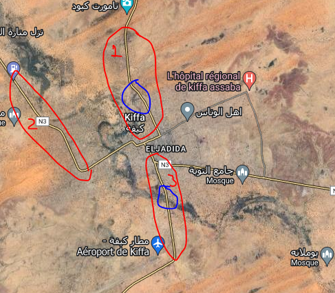
After zooming in and out I have established that only four main roads seem to be sealed so those are our obvious targets. Out of four roads, only three could photographed facing South (one, two and three circled red). For roads 1 and 3 we can see areas of vegetation around (blue circled areas) so let’s look at those closer.
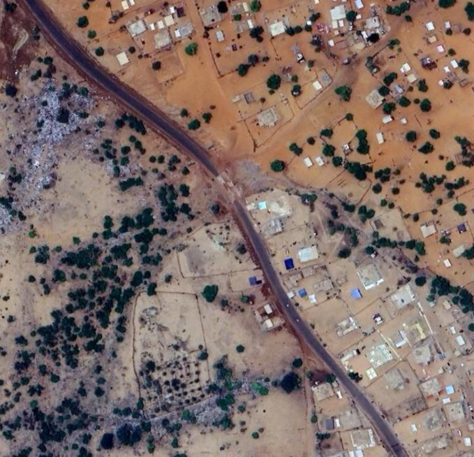
In this area we can see there's trees on the right hand side (remember, the camera is facing South) however the view would include buildings on the left rather than greenery in the background. Let's check the other one.
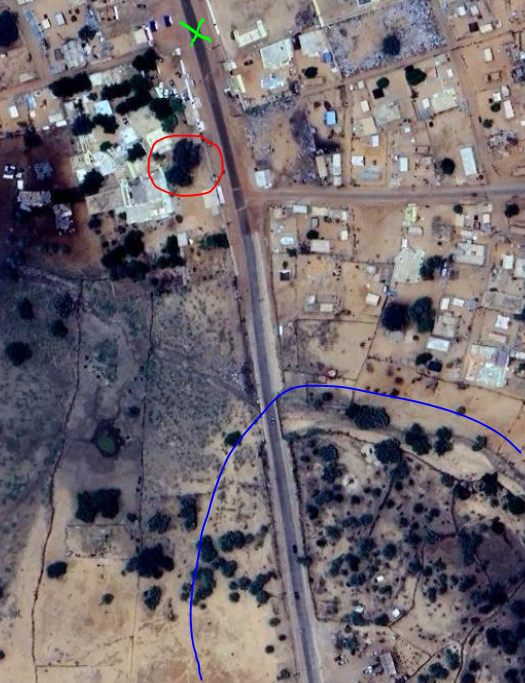
In this image we could see greenery in the background (blue) and potentially that tall tree on the right (red).
At this stage I'm mostly certain, the green cross is roughly the place where the photo was taken from however I'm only a beginner so I resorted to checking Sofia's walkthrough video which confirmed my thinking.
One point that she noticed and I didn't pay much attention to was that the road had a dip further down in the photo which lined up with the river bed in the satellite images.
Sofia also used Google Earth Pro instead of Google Maps as it provides much more detail - something I'll adopt in my next challenges.
Till next time
V