Kolpino Map Version English
PROJECT BY yoKolpino is a city within the Kolpino district of the federal city of St. Petersburg, an intracity municipal formation, a city of military glory of Russia.
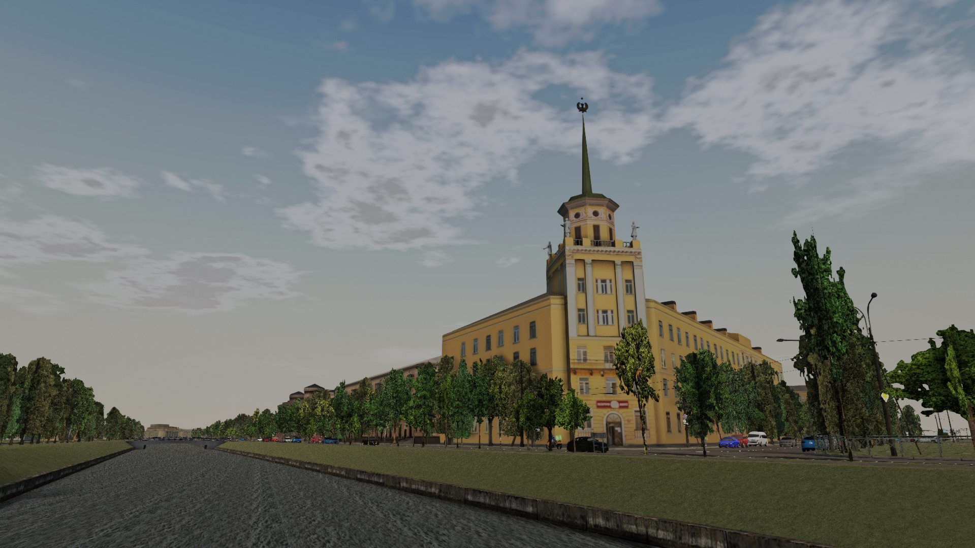
Development of the map began in October 2023 and continued until the end of April 2024 with virtually no pauses. The game map corresponds to reality by about 90%. During the development process, it was decided to build the city in parts. The first part includes Station Square, Oktyabrskaya Street, Pravdy Street, Bankovsky Lane, Truda Street, Culture Street, Cathedral Street, Freedom Boulevard, Sovetsky Boulevard, Victory Boulevard, Lenin Avenue, Communy Street, Karl Marx Street, Vera Slutskaya Street, Finlyandskaya street, Radchenko Brothers street, Krasnykh Partizan street, Gubina street, Fidernaya street and the Komsomolsky Canal embankment. In general, on the map it can be represented as follows:
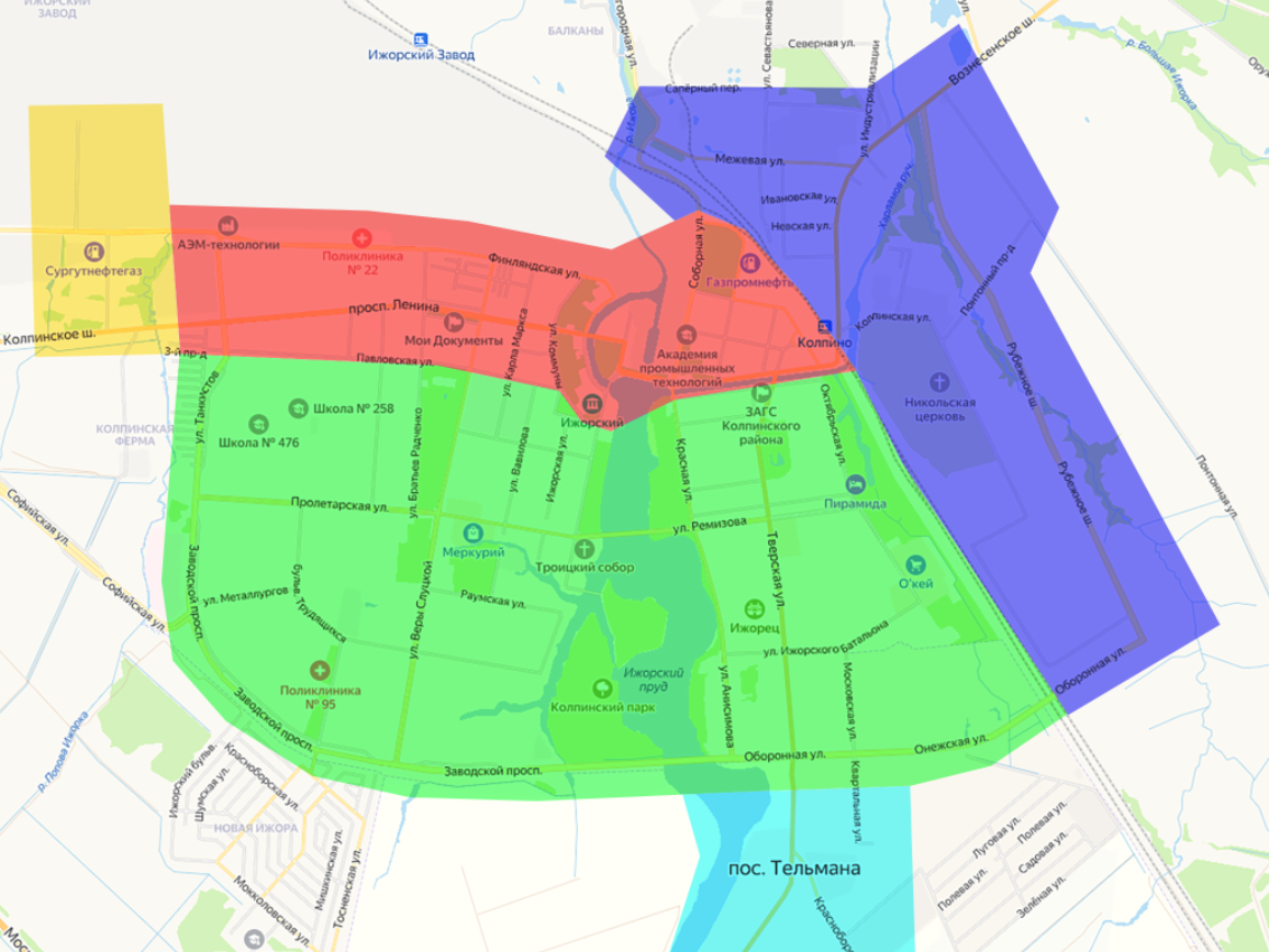
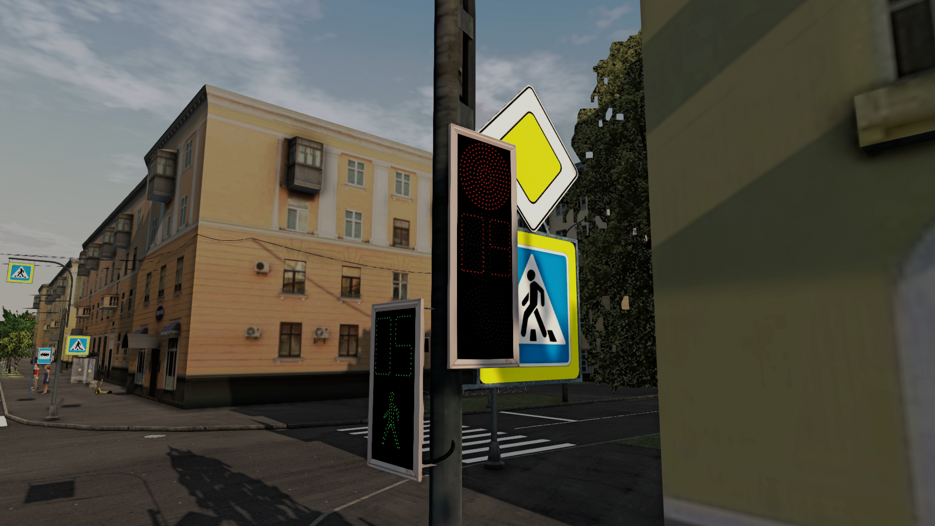
The first part is indicated in red. In the next update, the area around the Kolpinskoe highway and the building materials plant will be made; it is marked in yellow. Afterwards it is planned to expand urban development, it is indicated in green. It is expected that it will be further divided into several smaller parts. The area around Mezhevaya Street and the Kresty detention center is also planned, it is marked in blue, and the area around the village named after Telman, it is marked in blue.Further development of the map will not be so long, since the database of objects, such as signs, stops, lamps, etc., is already available, all that remains is to model the buildings, and there are not very many of them, since the rest of Kolpino mainly consists of the same type of multi-story buildings, arrange them and arrange other ready-made objects.When developing the map, all the shortcomings of previous maps were taken into account. To reach not only the audience of the computer version of the game, but also the mobile one, three versions of the map were made: Computer, Mobile and Mobile for very weak devices. The computer version is the most developed version of the map; it is made according to the same principle as Ponaeh City. The mobile version differs from the computer version only in the vegetation; here it is made using a different method, which in my opinion is easier for mobile devices. Mobile for very weak phones is the most lightweight version of the map, from which everything unnecessary has been removed, 80% of the vegetation has been removed and textures have been compressed to 512 pixels.At the moment, there is 1 fictitious route on the map from Pravdy Street to Feeder Street. There is no route number. In the future, as the map is developed, real routes will be added.The map contains personal developments that have no analogues, for example, traffic lights. In addition to the main signals, they show time in seconds.
Based on the voting, it was decided to open a fee for the first version of the card in the amount of 27 thousand Russian rubles. Further expansion of the map, except for the next update, will be distributed in the same way. We will soon inform you where to transfer your donations.
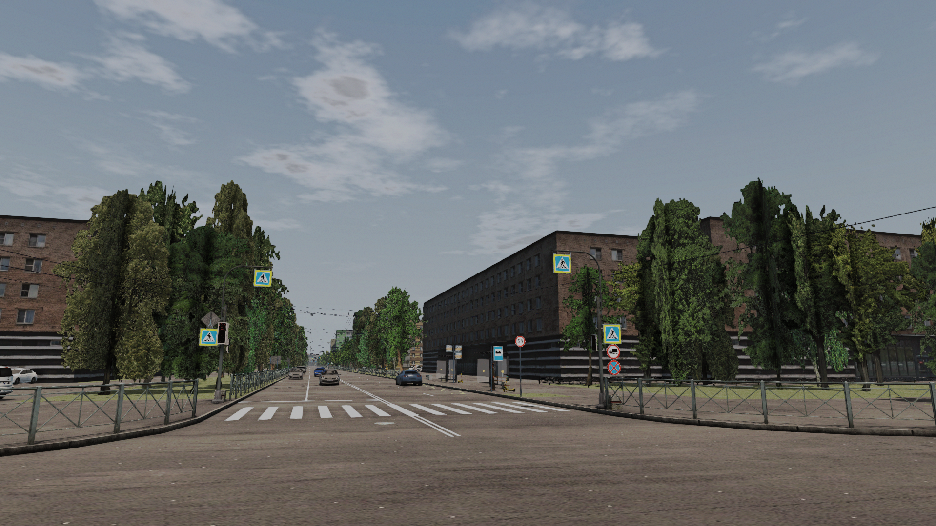
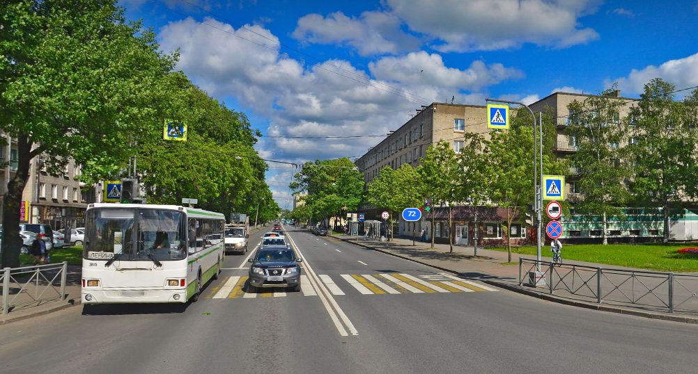
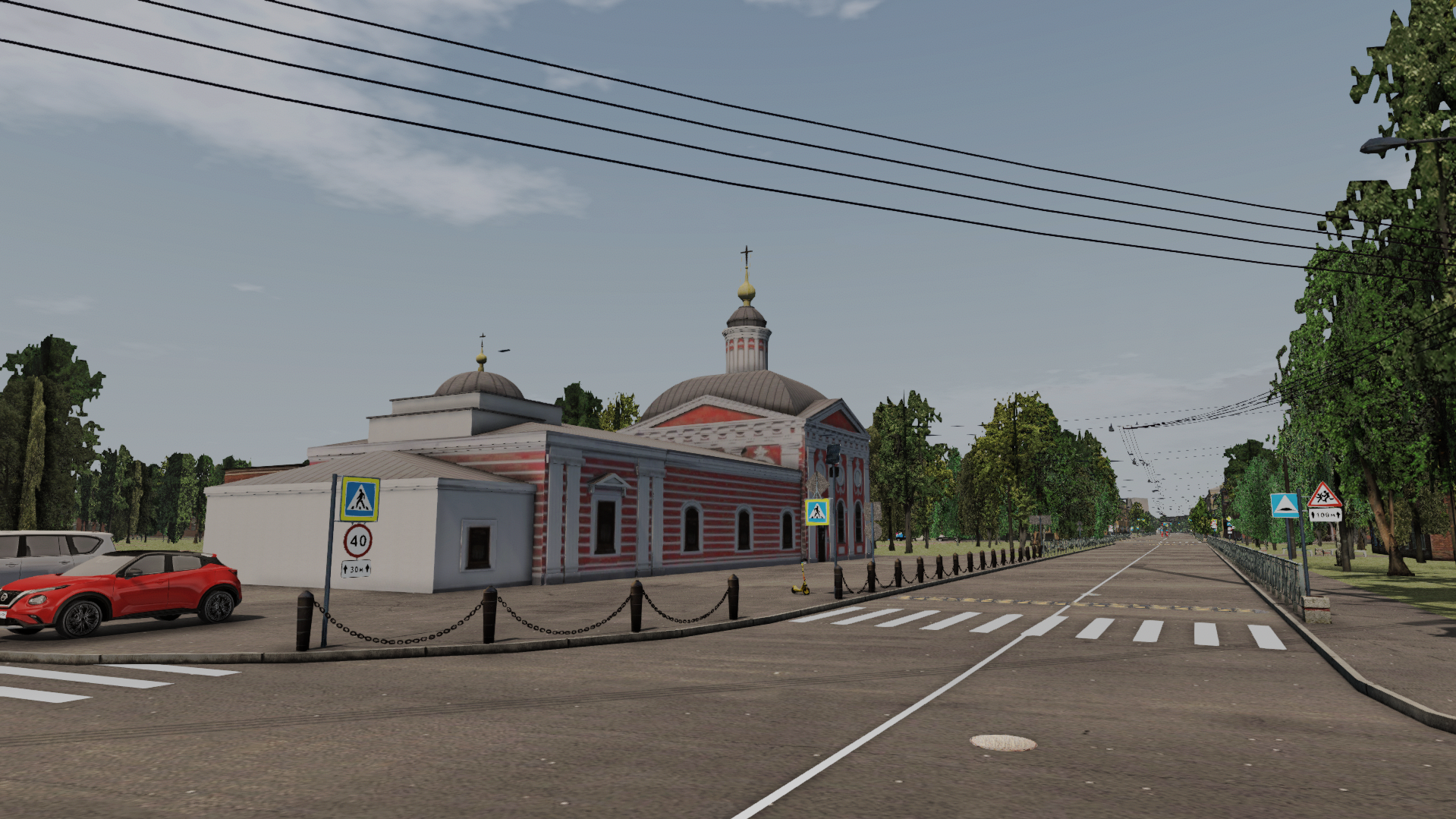
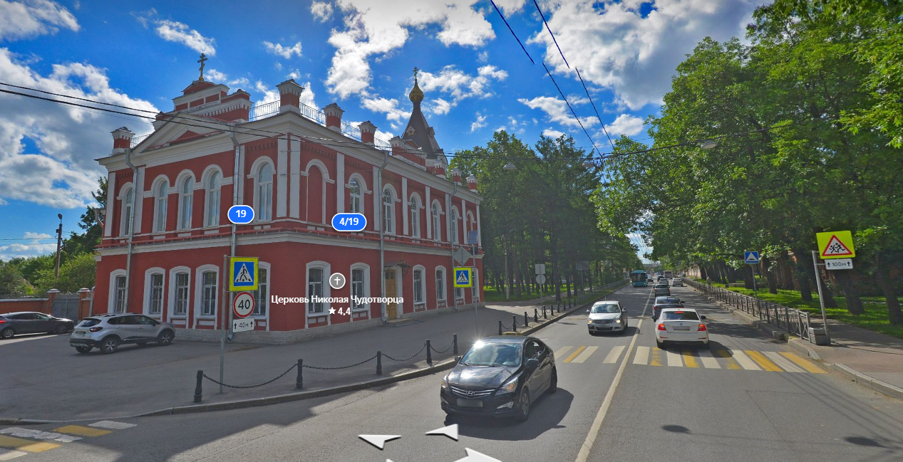
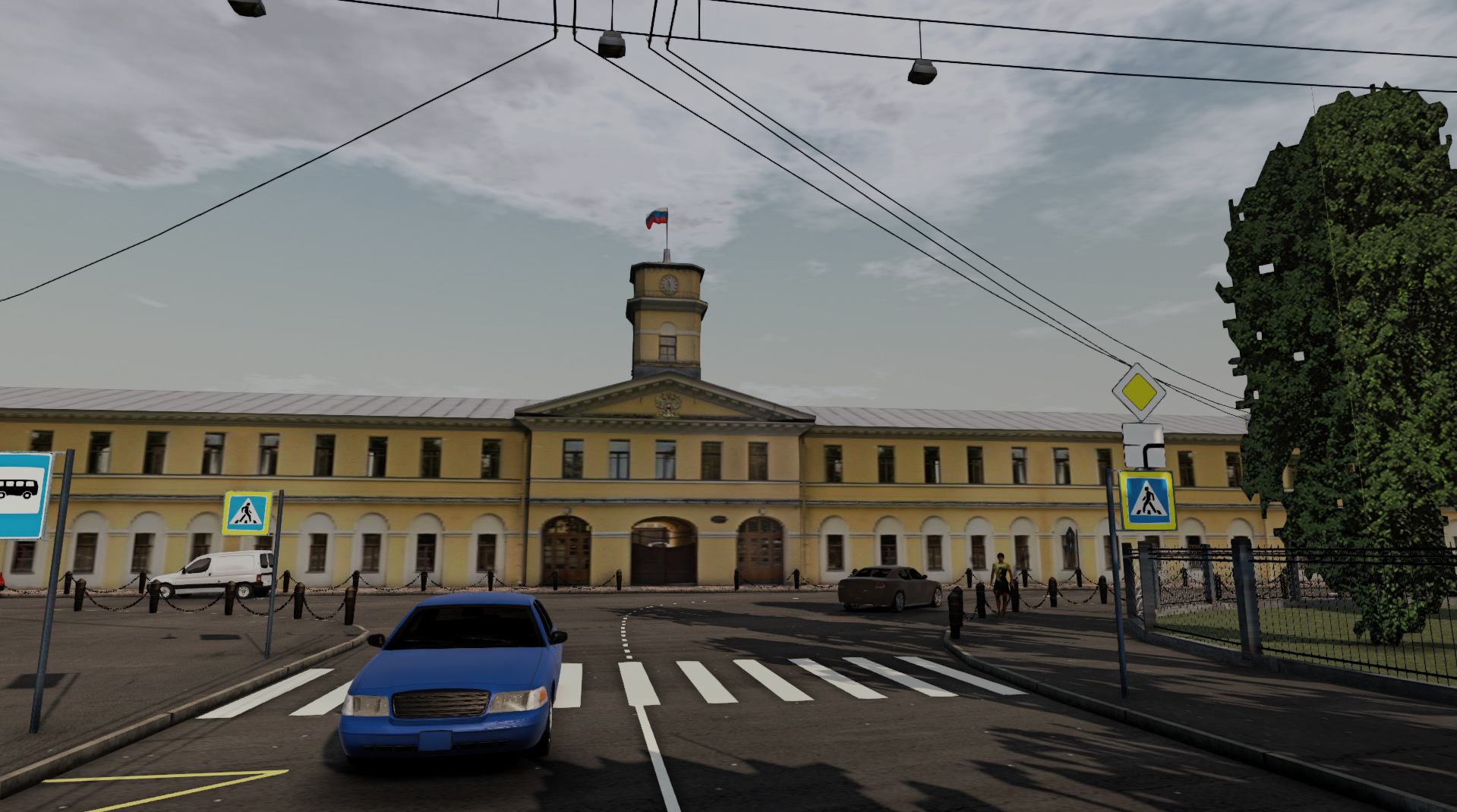
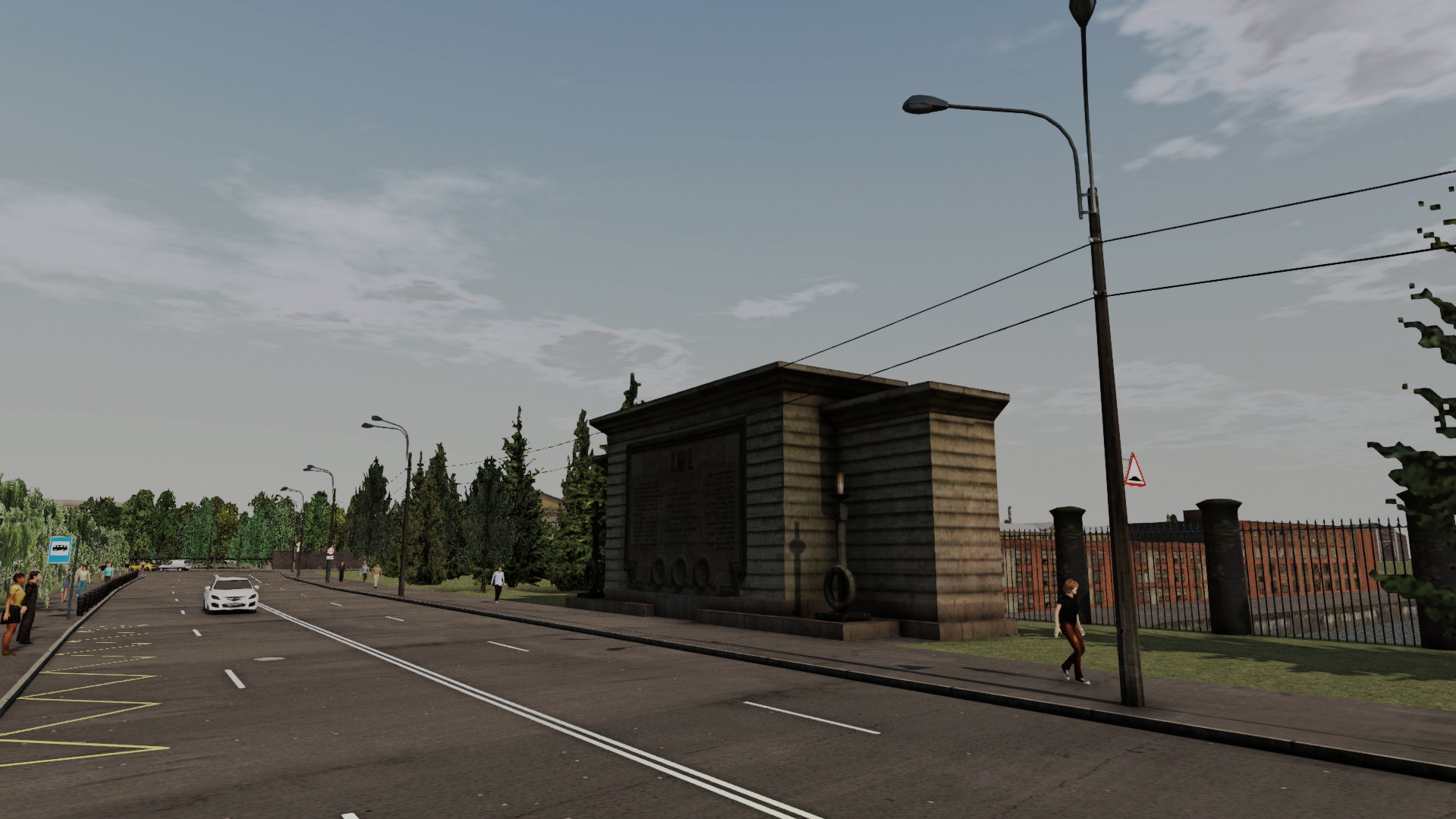
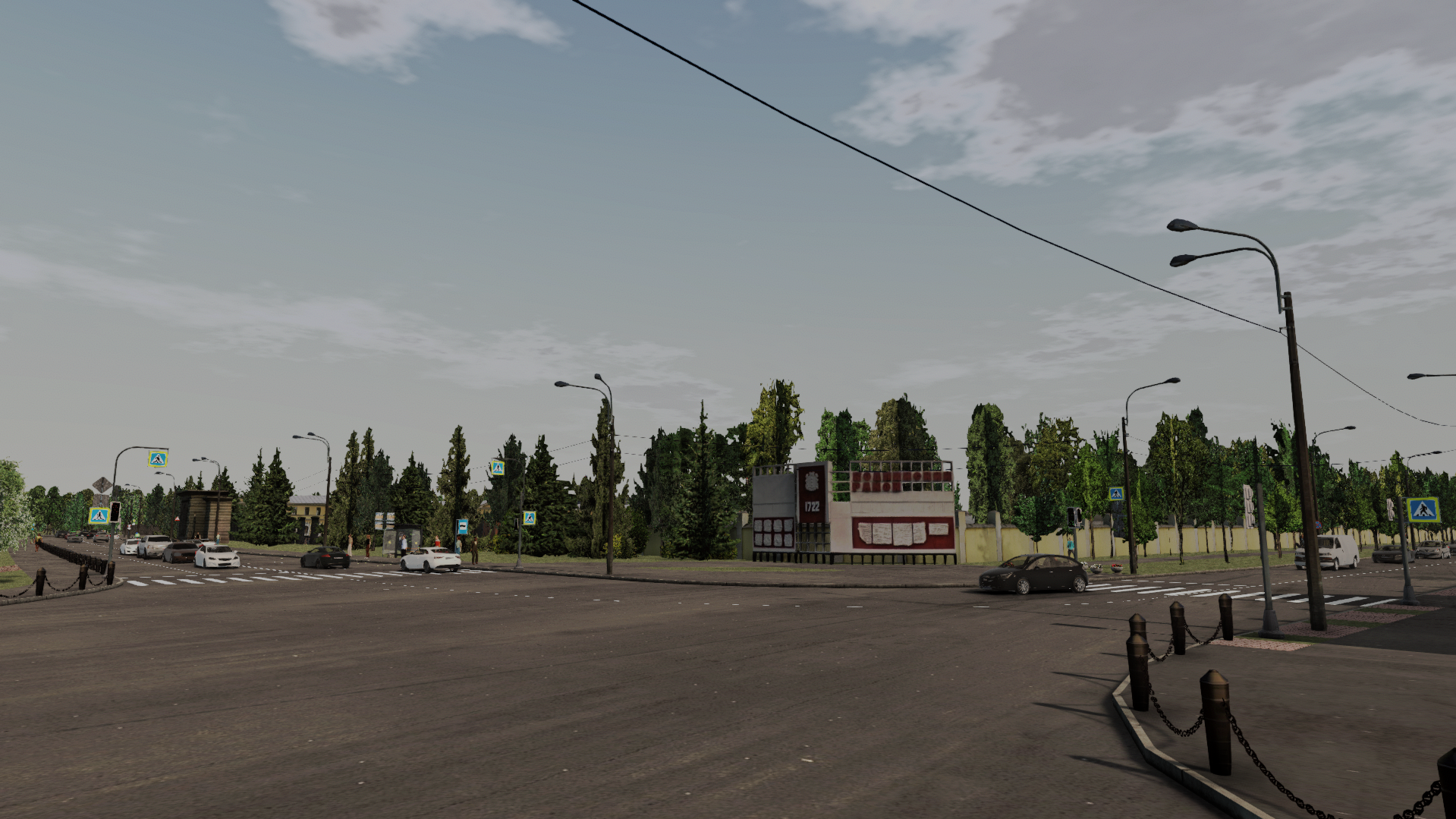
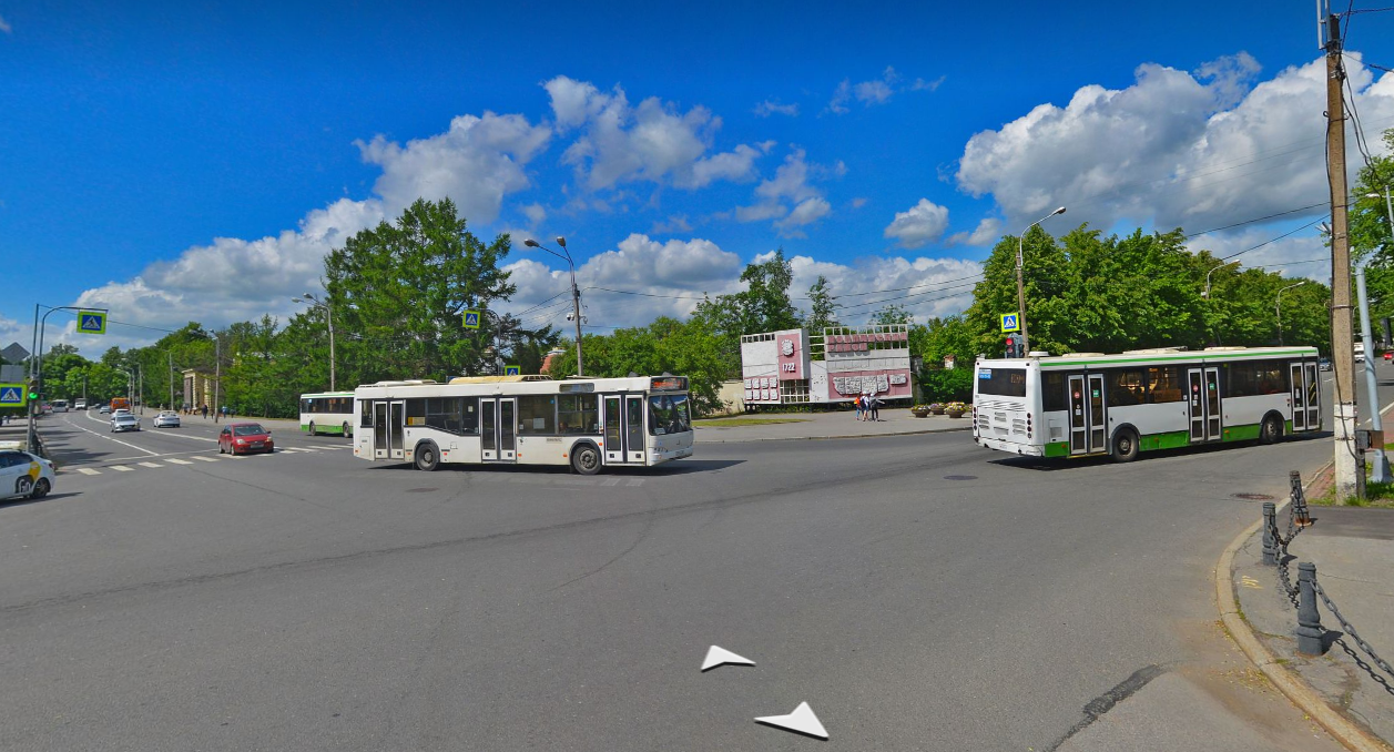
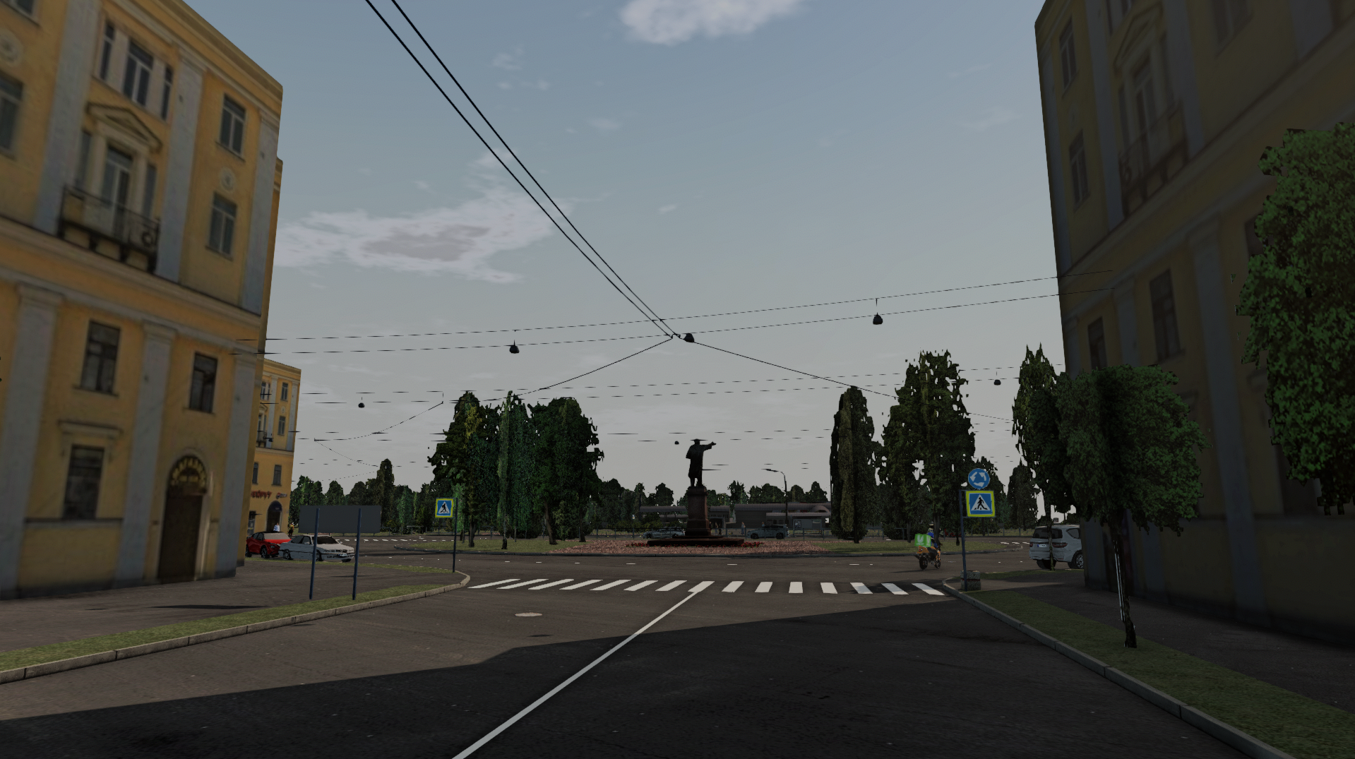
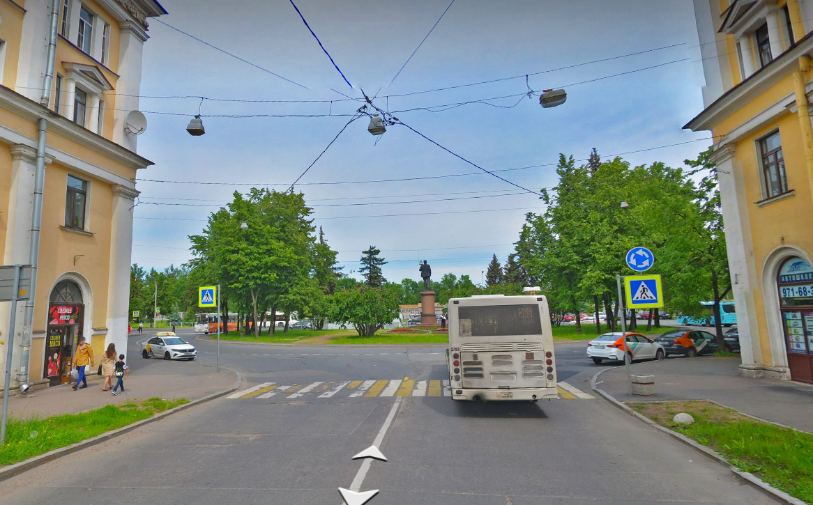
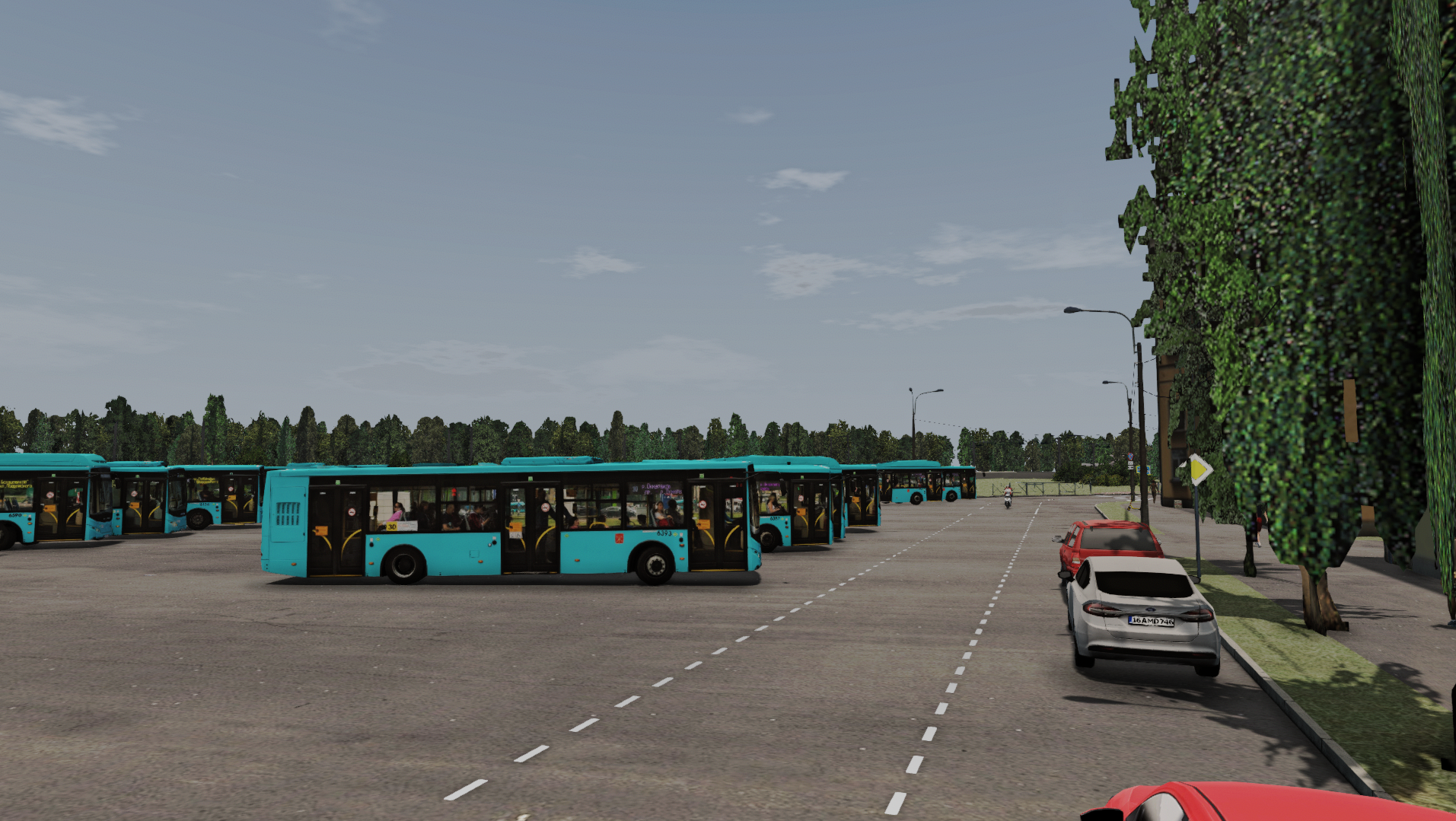
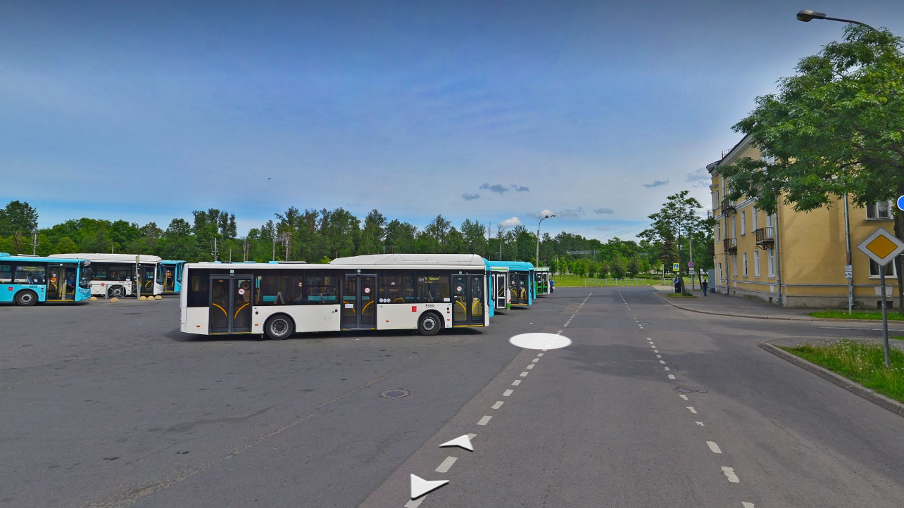
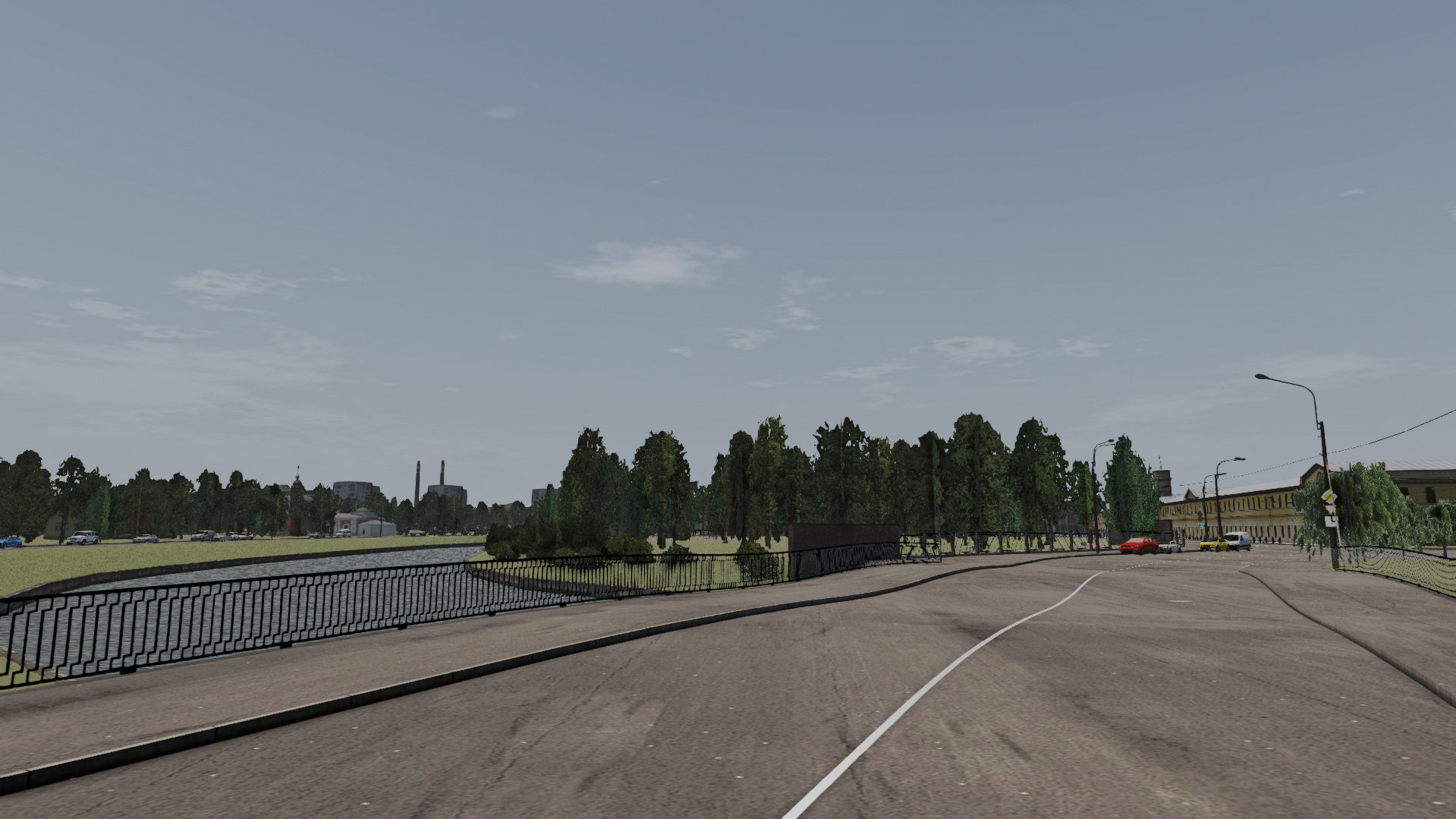
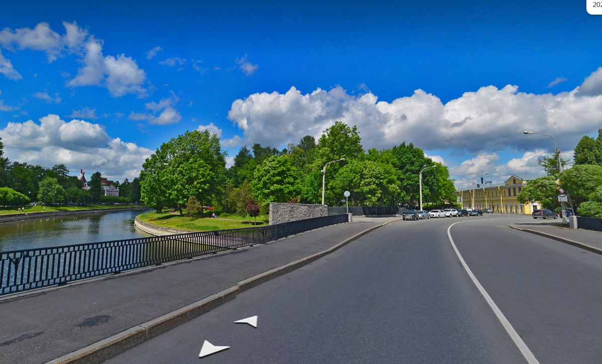
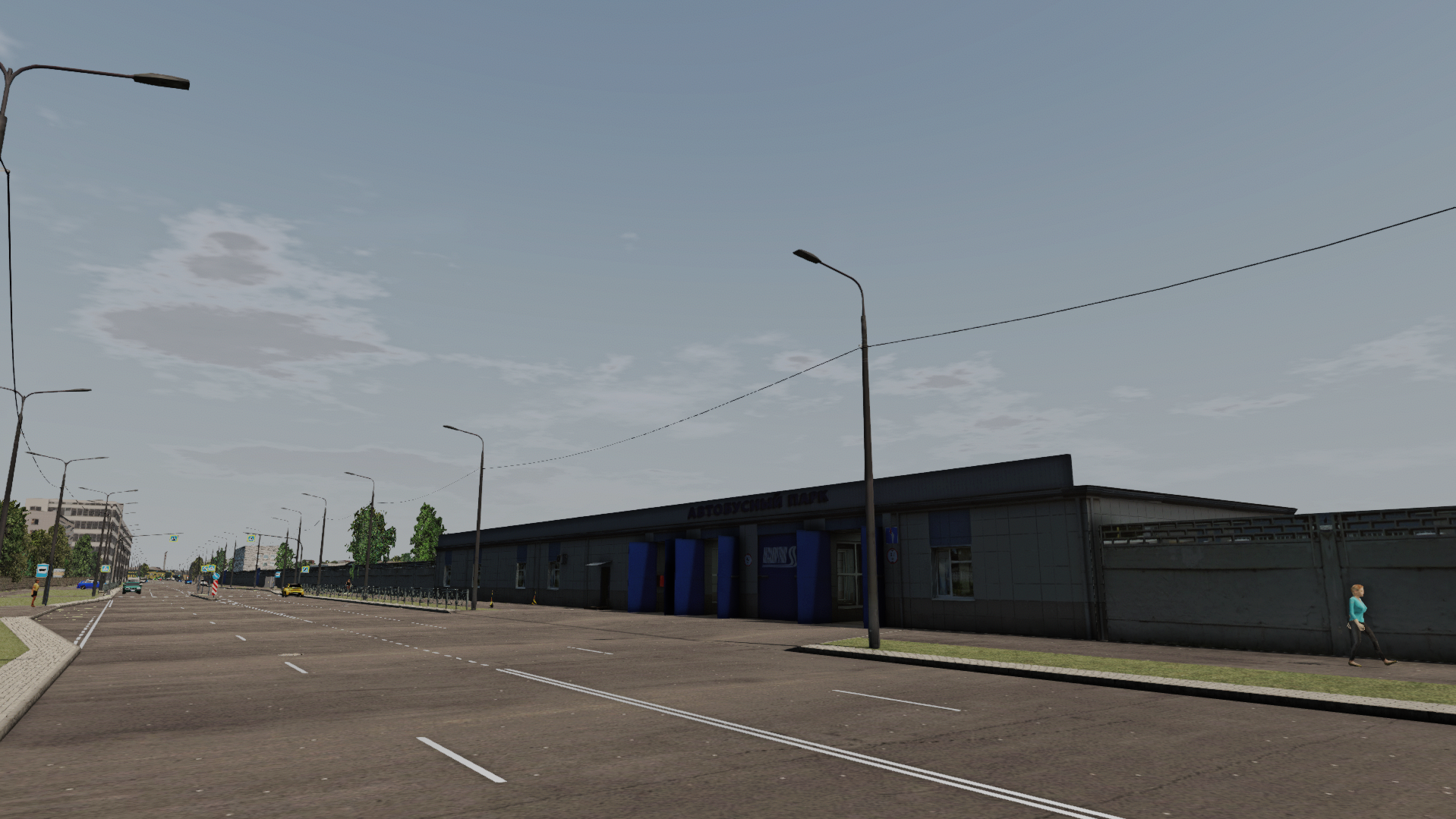
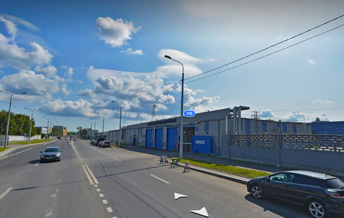
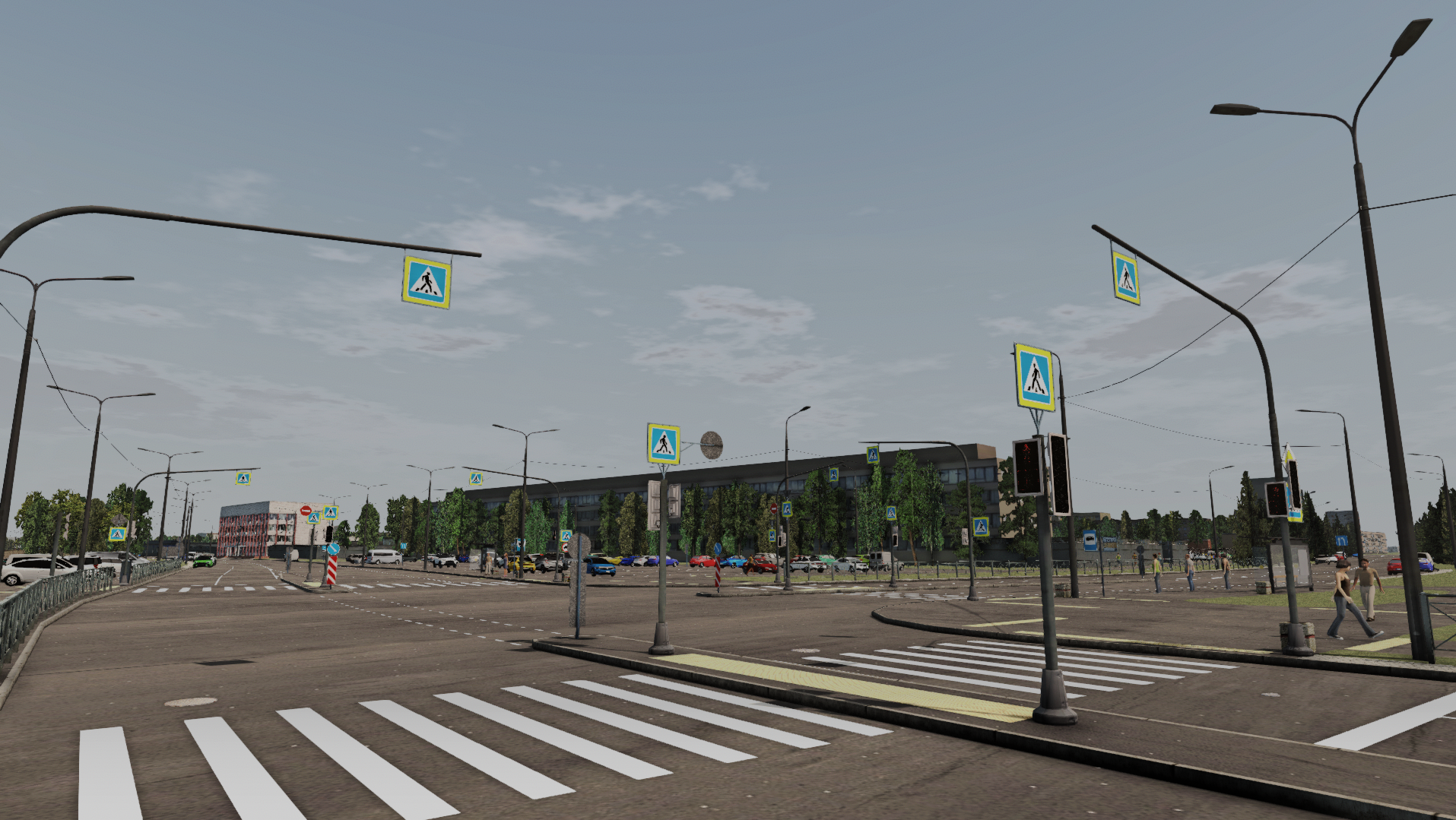
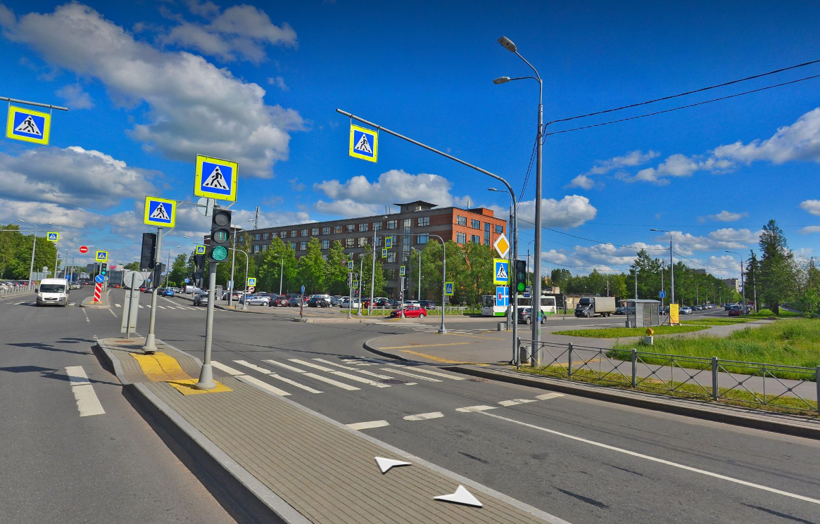
Below are screenshots from the game and real photographs of these places.