From this thread 🧵 you will learn about 12 key #OSINT-services for gathering information about a certain location
Cyber Detective • @cyb_detectivefrom this thread 🧵 you will learn about 12 key #OSINT-services for gathering information about a certain location.
i'll show it an example of this place:
bürglenstrasse, 3006 bern, switzerland
46.944560,7.467839
(coordinates are defined by latlong.net/convert-address-to-lat-…) [#1]

Step 1 app.skylens.io/
get geolocated posts from #Twitter, #YouTube, #Instagram, #Flickr, #VK (for the last two weeks)
read about how to get older data below in the thread [#2]

Step 2
mattw.io/youtube-geofind/location
search for #YouTube videos on the map, with the ability to filter videos by publication date, duration, channel name and other parameters. [#3]

Step 3
photo-map.ru/
search geolocated photos in #VK.
it is possible to filter by user's gender and marital status [#4]

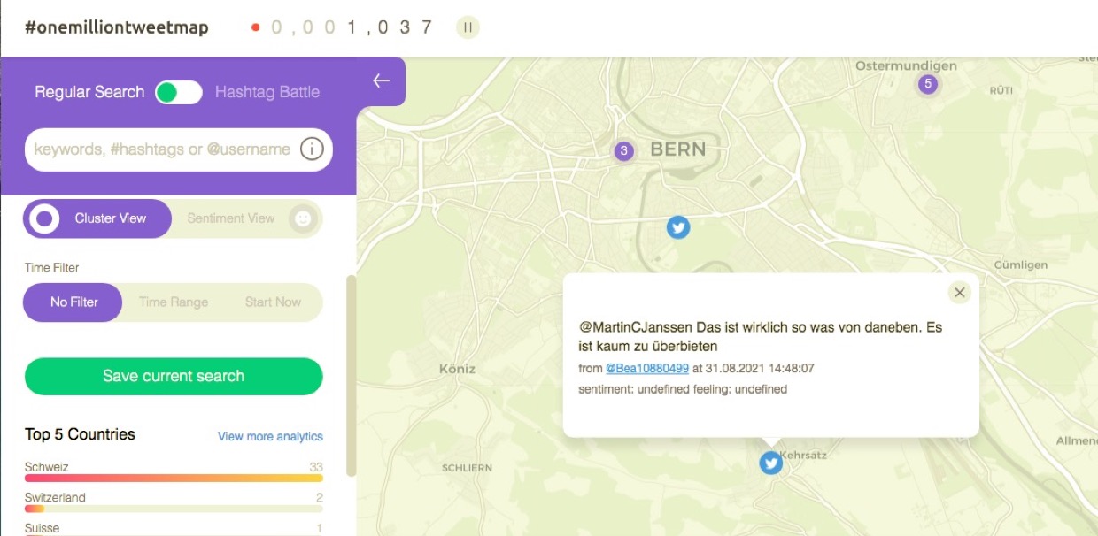
Step 4
onemilliontweetmap.com/
View geolocated tweets [#5]
step 5
view geotagged photos on #Flickr
flickr.com/map [#6]

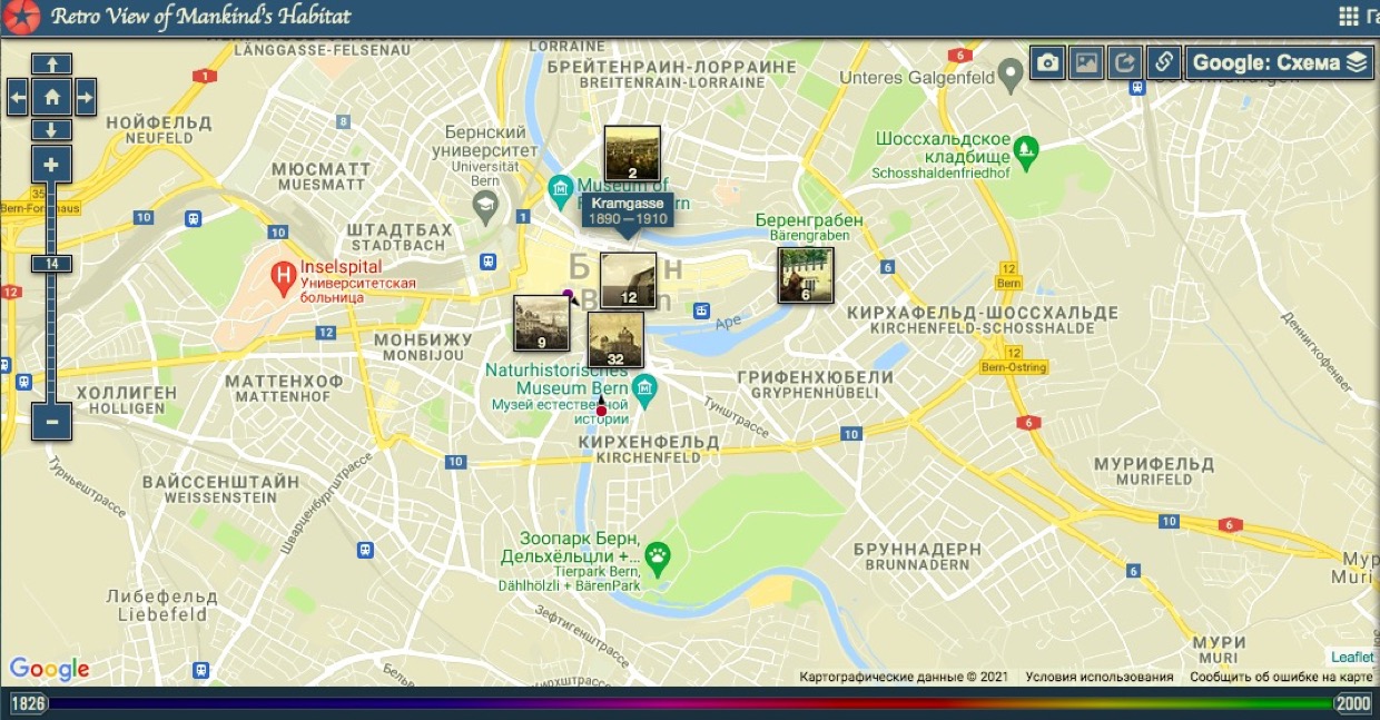
Step 6
View geolocated retro photos (from 1826 to 2000)
pastvu.com/ [#7]
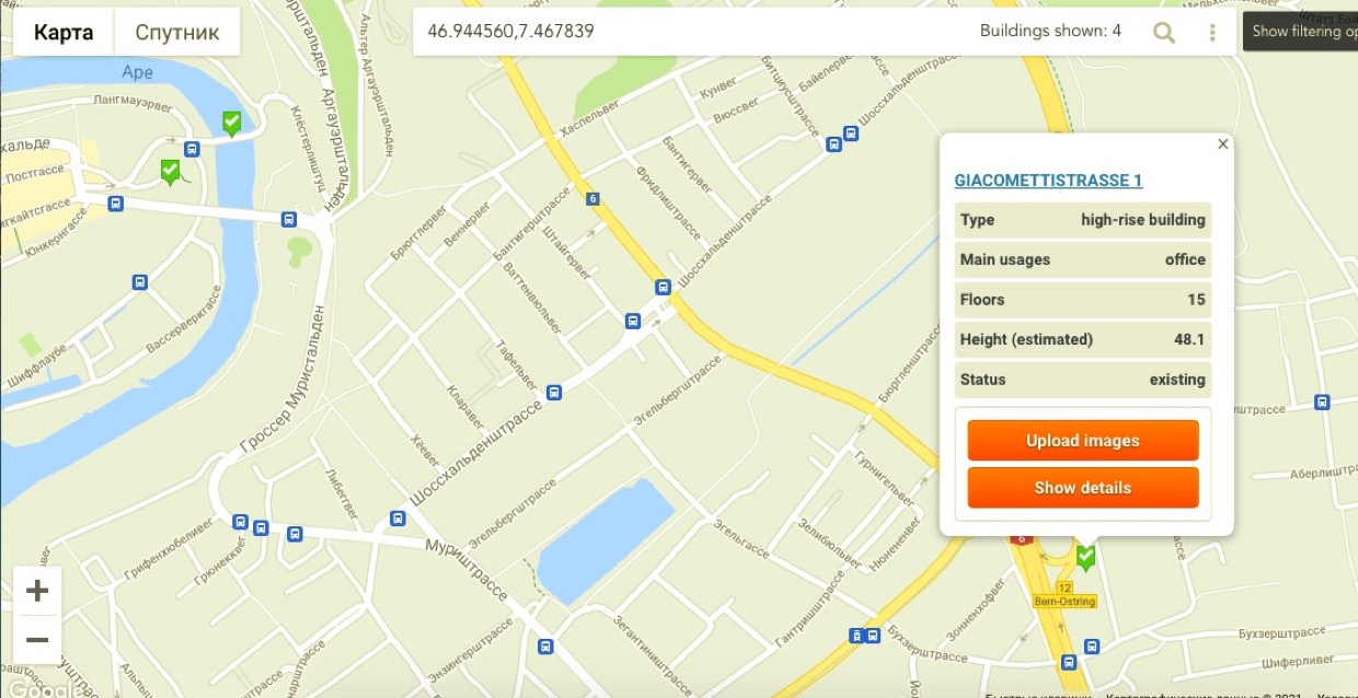
Step 7
Learn information about significant and interesting architectural sites nearby.
emporis.com/buildings/map [#8]
Step 8
See images from nearby surveillance cameras
webcamtaxi.com/en/map.html [#9]

Step 9
Examining data from the public cadastral map
cipher387.github.io/collection_of_c…
map.geo.admin.ch/ [#10]

Step 10
We research weather conditions in detail and, if necessary, obtain data from the past (for the past two years)
ventusky.com/ [#11]

Step 11
See what air routes pass over the city.
globe.adsbexchange.com/ [#12]
Step 12
We study the routes of public transport that pass near the place under study.
tracker.geops.ch
cipher387.github.io/public_transpor… [#13]

This thread is end.
But it tells only a small fraction of the information that can be gathered by location. There are also local conflicts, forest fires, lightning strikes, cats living next door...
More interesting maps at
cipher387.github.io/osint_stuff_too… [#14]