ARCTIC CIRCLE
Edubaba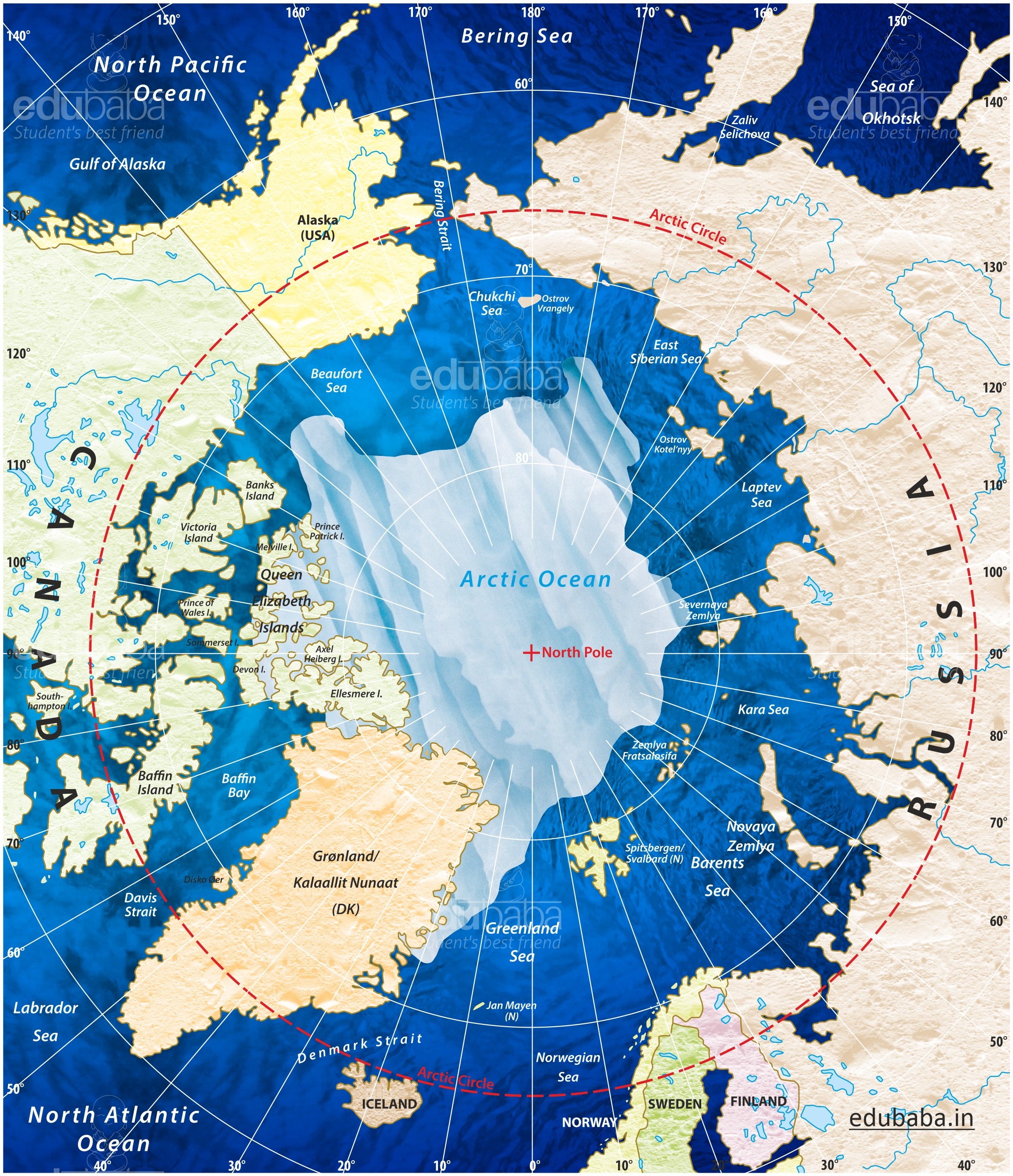
The Arctic Circle is one of the five major circles of latitude that mark maps of the Earth.
It marks the northernmost point at which the centre of the noon sun is just visible on the December solstice and the southernmost point at which the centre of the midnight sun is just visible on the June solstice.
The Arctic Circle passes through the Arctic Ocean, the Scandinavian Peninsula, North Asia, Northern America, and Greenland.
The land within the Arctic Circle is divided among eight countries: Norway, Sweden, Finland, Russia, the United States (Alaska), Canada (Yukon, Northwest Territories, and Nunavut), Denmark (Greenland), and Iceland (where it passes through the small offshore island of Grimsey).
The region north of this circle is known as the Arctic, and the zone just to the south is called the Northern Temperate Zone.
The position of the Arctic Circle is not fixed and currently runs 66°33′48.3″ north of the Equator.
The Arctic Circle is roughly 16,000 km (9,900 mi) long. The area north of the Circle is about 20,000,000 km2 (7,700,000 sq. mi) and covers roughly 4% of Earth's surface.
The Arctic Council is a high-level intergovernmental forum that addresses issues faced by the Arctic governments and the indigenous people of the Arctic. The eight countries with sovereignty over the lands within the Arctic Circle constitute the members of the council: Canada, Denmark, Finland, Iceland, Norway, Russia, Sweden, and the United States. Outside these, there are some observer states.
For More Join us on Telegram: @edubaba Website: www.edubaba.in