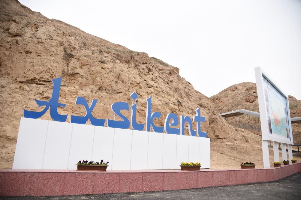
AKHSIKENT
Tourism development instituteThe ancient settlement of Akhsikent (Akhsi) - is located on the right bank of the Syr Darya river, on the territory of the present-day Namangan region.
Akhsikent was divided into two parts. The central part was occupied by the citadel, surrounded by the walls of Shahristan (the inner city), and a Rabad (suburbs) – the area where artisans lived. Aksikent occupied an area of more than 30 hectares. The citadel was separated from the city by a wall, and a deep moat was dug around the perimeter of the outer city walls. Trade and handicraft production were developed in the city. In the 7th – 8th centuries, Akhsikent was one of the Central Asian centers for the production of cast steel.
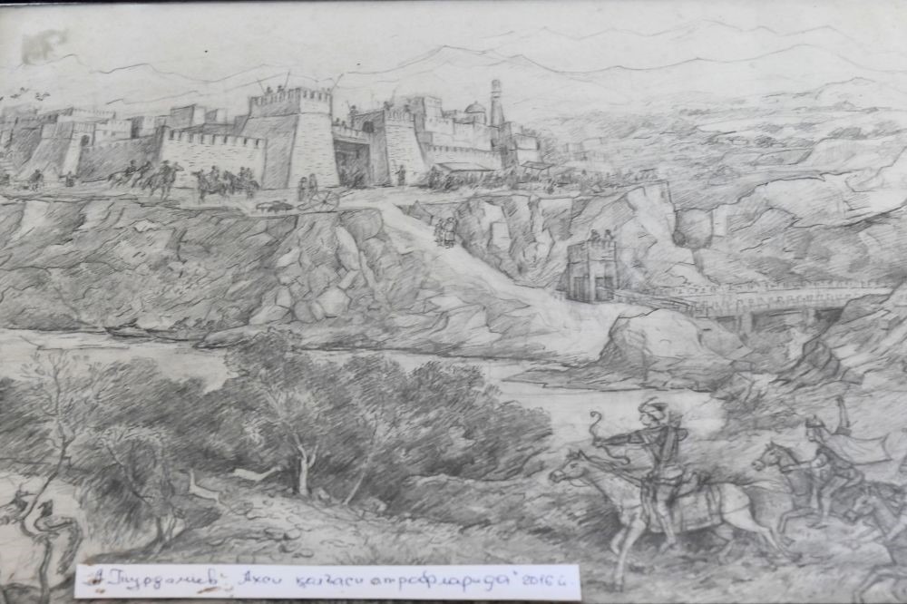
In the 10 – 13th centuries Akhsikent was one of the main cities in the Fergana valley. At the beginning of the XIII century, the country was attacked by Mongolian nomads trampled and left Akhsikent in ruins. However, the city was rebuilt and was considered a large city. During the reign of Babur's father Umarsheikh Mirza, the city became his residence. An earthquake in 1620 demolished the new settlement, and the inhabitants were forced to move to nearby Namangan.
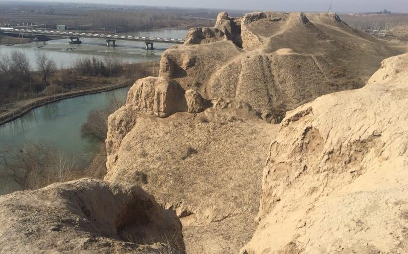
According to archaeological data, the city originated in the 2nd century BC and was one of the largest cities of the ancient state of Davan. The ancient settlement has long attracted the attention of researchers as a multi-layered object that allows one monument to study the stratigraphy of cultural strata that have accumulated over many hundreds of years. The monument was also promising in terms of studying the features of the development of a large medieval city that characterizes the culture of an entire historical and cultural region – Fergana.
Archaeological research has established that the ruins of Akhsikent belong to three geographically separate settlements of different times: ancient, pre-Mongol and the Timurid. Studies have revealed many important aspects of the life of the ancient city – its urban structure, fortification, residential and artisan-industrial quarters. Akhsikent was the only place in the East where the high-quality steel known as Damascus had been produced.
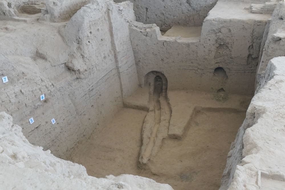
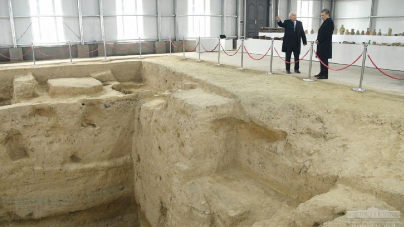
Excavations were conducted in different parts of the settlement. The arch of the pre-Mongol Akhsikent is located in the South – West corner of Shahristan. In the plan, it is perceived as a triangle with an acute angle directed to the East. More than half of the area of the arch was washed away by the Syr Darya during periods of flooding. As a result of excavations, two layers were recorded in the arch. In the upper layer, ceramics of the 15th – 16th centuries was found, and in the lower layer, seven residential and economic premises belonging to the 11th - early 13th centuries were excavated. Among the finds are fragments of ceramic and glass products, coins of the 10th-12th centuries. Excavations of residential quarters indicate a high level of medieval urban planning and the improvement of the structures of Akhsikent, which in this respect was not inferior to the central cities of Maveranahr - Bukhara and Samarkand. Part of the cities and large settlements were supplied with clean spring water, provided by clay pipes-kubur. Castles and palaces had a centralized heat supply. The aristocracy and rural classes had house baths in their estates. Local inpatient hospitals were successfully operated in the city. A public cemeteries were arranged only outside the walls of Rabad-the city suburb.
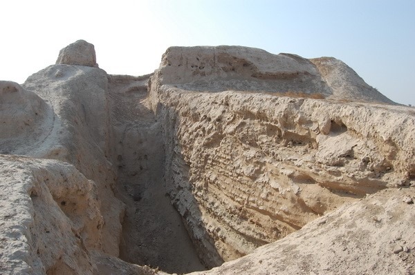
Reports of written sources about the topography of the city of Akhsikent, its structure and quarters are confirmed by the results of archaeological excavations. During the excavations, even more detailed information was obtained about some parts of the city, its individual buildings and also about handicraft production. As a result of research in 1980-1983, along the northern fortress wall of the Arch on the ancient settlement of Akhsikent, a complex of eleven rooms was excavated, the rooms were located in a single row from west to east. Adjacent to each other, the rooms did not have, with rare exceptions, a direct connection with passages, and existed in isolation from each other. On the side of the northern facade there was a common north wall for all rooms, cut to a certain height to form an open gallery, through which communication between the rooms was carried out. Behind the southern wall of the premises begins a cliff to the Syr Darya river.
Akhsikent was one of the transit points of the Great Silk road. It had its own underground water source, was convenient for defense. Today, Akhsikent is the largest archaeological monument of the Fergana Valley, part of the ruins of the city with an area of 60 hectares has been preserved. Archaeologists have unearthed a blacksmith shop, the remains of a bathhouse of the 10th-13th centuries, barracks, Friday mosque, fortress walls, underground irrigation systems, a living quarter of artisans, the ruler's Palace.
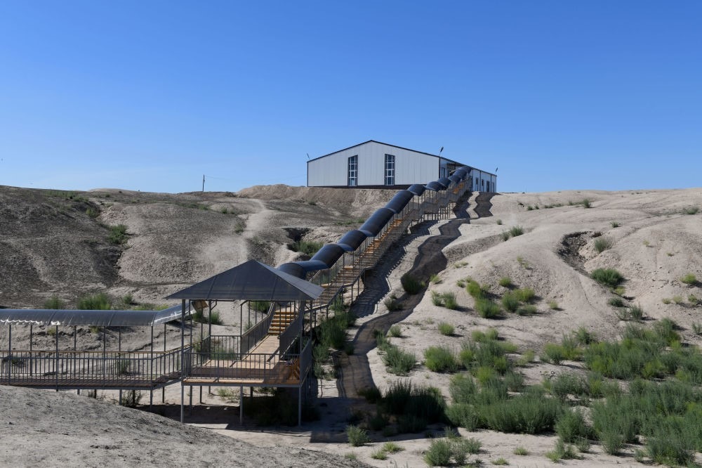
February 28, 2019 the city of Aksikent was visited by the President of Uzbekistan Shavkat Mirzieev. It is planned to build a tourist infrastructure, create a museum, build a symbolic arch as a sign of the former glory of Akhsikent, as well as install a monument of Umarshah Mirzo, the ruler of Fergana (15 century).
METHODICAL RECOMMENDATIONS:
1. Warn the group that the area is open and under the sun, it is necessary to carry hats and sunscreens.
2. You should inform the group about safety when visiting the archaeological sites.
3. The guide should provide all information about the ancient settlement on the bus.
4. The work of the guide should consist of 20-25 when showing and telling about the object (as well as 10-15 minutes for additional information, if tourists are interested).
5. Tourists are given 15 minutes of free time for independent inspection and photography.
Compiled by: Kovalenko K., a guide of the second category.
Translated by: Azarenko E., a guide of the first category.
Tourism development institute under the State Committee of the Republic of Uzbekistan for Tourism Development
👉 Join it: https://t.me/guide_portfolio